The Ride: Tacloban To Palapag
Let's go (na talaga)! This was it! To Northern Samar's Pacific Coast I went!
How My D-Day Started
D-Day (departure day ba!), 2 days after I went to reserve this ride, 06:51AM, I was at 7 Eleven beside the highway, waiting for a call. None so far. It was still early anyway.
If the van left their downtown terminal exactly 7AM as scheduled, it probably would take 15~20 minutes max, to where I stood at Nulatula. Not a long wait, but anxious!
Enough time for me to ransack the shelves of 7 Eleven! Marlights, seldom do hinter town sari-sari stores have that; Coke Zero, but I cannot cram those in my backpack.
I said 'let me drink at least one can before I fast on this beverage for the next few days.' Argh! But happy thoughts lang, maglalakbay tayo! Oks na, sinamahan pa ng Siopao!
I usually don't eat breakfast, but hello, this was to be a 7, 8 to even 9-hour ride. Who knows if the driver would even stop anywhere and for how long. Ang Hypoglycemia!
Alright. Exactly 0721H I got a call from an 'unidentified number'. I answered as I was dead sure it was Turbanada. It was the driver with an opening line of 'hain ka banda'.
I immediately felt this was not going to be a good start. Waray batasan. Taga huron! I politely answered anyway, as this as***** was to be beside me, for at least 7 hours.
2 minutes after that, the teller girl called, asking if their driver already contacted me. I said yes. And I waited for probably some 5 minutes more before the van appeared!
Hala Tikwang! [Let's go!]
0729H I was rolling. Yey! And exactly 0735H here we were near the EVMC. Oh, did you know it is not anymore EVRMC? Yeah, they removed the "Regional" from their name. Its now just Eastern Visayas Medical Center. As if that matters to us, 'no?
Eh, kung ako tatanungin, I'll call it KEVMC - The Referral Hospital! K for Kawawa. Eh I heard from hurub-hurub, that is what they are heheh - overcrowded due to referrals!
Ay, marites told me, that public hospitals of the region (provincial, district, etc.) have this 'habit' of just outright referring patients to EVMC, citing this and that reason. Ta!
How convenient 'no? Their hospitals have budgets provided by the government, and all they do is refer their patients to this EVMC. Ultimo daw samad la (sugat; wound)!
An interesting topic. But I'm traveling okay? And that's not my cup of tea, really!
Let's 'move on' malayo pa ang Palapag hahaha!
A future roundabout almost done:
Meters ahead, the van approached this now well-known corner-under-repair... Without the San Juanico Bridge closure issue, this corner was already news-worthy as it is nearing completion. Why? The diversion road (to the left) is already finished!
Once opened, we could go to the southern end of Tacloban, bypassing city traffic. That is that development at left. Going straight is to Babatngon and Tacloban North relocation sites. Work is in progress, reason why the SUV and tricycle are detouring.
Anticipation for the final outcome of that corner (a rotonda?), and eventual opening of the diversion road was 'hot news', until eclipsed by the sudden SJ bridge closure.
Crossing the San Juanico Bridge
I remember that closure thing was announced something like a day or two after the elections and effectivity was 15May. Disallowed vehicles lined all the way to EVMC. It was chaotic. I saw it. Some passengers even walked crossing that bridge, under a heavy downpour! Vehicles less-than-3-tons were also delayed due to one-way traffic.
That issue was why I did not ride a bus to Palapag. That is also what the Turbanada staff was telling me, that even vans took an hour or two longer. A hot SocMed topic.
Not only on social media, traditional news outfits were all at it too. The AM radio of this van I was riding was discussing the issue. So I was ready for an 8 to 9 hour trip.
Teka teka, I took a video of my experience! I'll put that here soonest. Aw eto na!
Observation: We approached the area and "joined the line" at 0737H. At 0759H, we were already past the line of vehicles, stranded buses and trucks, on the other side.
Our entire crossing experience was 22 minutes. Well, under normal circumstances, that may have been only 5 to 10 minutes. But, why is Turbanada "plus 1 to 2 hours"?
Exagg! Well, maybe I was just lucky today. I always am anyway!
Hey, I am not trying to downplay the effects of that sudden bridge limitation. I even already saw some repercussions along the way, but I will tell you about them later.
On the roads of (Western) Samar (again)...
It's been on quadmedia and every kind of social media site. The worst of roads...
Warays are quick at naming things. This stretch of Western Samar road already has many names. The ones I like are: Luxurious - meaning lukso ng lukso ang sasakyan mo; Most Holy Road - the road has a lot of holes! Other names are about politicians!
Aw let's not wallow on issues forever! I'm on tour, happy thoughts dapat! Like this: Of course you see him and you know what he's doing, right? But I can assure you, in this country, educated or not, under normal circumstances, no one would dare do that!!
And this was not a normal circumstance hahaha! We were at a road re-blocking area, waiting for the north-bound vehicles' green light. If he went and faced to the right, it was a very deep ravine he could fall off easily. If he went left, a cliff being bulldozed!
Let's further dissect this important Philippine Travel Phenomenon. Yes, me ganun oy!
If you were him, where would you "situate" your self? Aber? Bangin sa kanan, bangin sa kaliwa, maputik pa! How and where would you relieve your self of that quandary?
Emergency yan, did you know? Aba, pag nagpupumutok na ang pantog mo, lahat ng bagay ay hahamakin, pagkat wala ng paraan, na iyan ay pigilin! Kahit na ilang tinik...
Teka teka, bakit parang me kumakanta... ikaw ba yan?
So, if you were him, where would you face and make wasiwas your thing? Sige na, if you must face & pee on your vehicle, at which side? Tama ba yang ginawa nya? Ha?
Why not in front facing his vehicle? No one inside that fiera would see his little thing di ba? Or why not at the back, still facing their vehicle? We the people in cars behind them would not see his dark little junior, right? All we might see is his pee-shivering!
Now imagine... you're a female caught in that same situation. How'd you do that?
Hay the rigors of "long travel"! Not because the destination is far, but because roads (of Western Samar) are improperly maintained. Repairs start, only when it's too late.
Here's an interesting scene still on the roads of Western Samar. Very topic-worthy! First, at left, that heavy truck is carrying concrete electric posts. Salamat SAMELCO hahaha! At least that 'electric service' isn't acting up nowadays. DPWH ang starring.
You see those vehicles far in the distance? They were running slow because 1) it's a downward slope of this mountain road; and 2) there are many cracks and potholes!
Eto, this is much clearer, though the SAMELCO 2 truck isn't anymore in the scene. Let's discuss children... is that normal for a highway? The concrete looks "still new", yet it already has many cracks and holes. That's always the case in Western Samar.
And, if you are driving a vehicle, light or heavy, coming down that slope from high up the mountain, would you not slow down? Baka pag-lukso ng awto mo eh... simba ko!
But happy thoughts lang... I loved looking at those loaded motorcycles! Like this: Delivering produce from farms to markets. That one has cabbage and... kalamansi?
Another nice though smirk-worthy scene of habal-habals inching up the patchy road. What makes the scene 'smirk-worthy'? Aw, the orange-man at right! A DPWH worker. Howsoever you beautify the sides, if the middle is tagpi-tagping luksoryos road... hai!
Aw, Warays don't welter on ugly roads. Life must go on - including marites! Like this: At talaga naman, ganyan pa nila naisip mag-discuss ng kanilang "corporate affairs"!
I loved this "unforgettable scene"! Epic!
What made that live tableau even more 'hilariously memorable' (to me) was that: my bontogin of a Turbanada driver honked on them several times - in quick succession!
The response: that rider at left casually waved his left hand forward, as if to say "go on ahead, overtake at this side, don't tail us" hahaha! I wanted to stand up and clap!
But I was seated in a running L300 van, beside the furious driver. Ukdum la hahaha!
Btw, if you're not 'busy' at the swaying and jumping of your car, views are grand! This section of the highway winds down from the mountains to the town of Calbiga.
Somewhere along, another re-blocking. There are a lot of these in Western Samar.
Nothing really wrong with this. There are just so many. And that, delays your travel.
Alright alright... fast forward, and we arrived Buray at 9:49AM - more than 2 hours! That store, Shelo Jean Carinderia, is where all Turbanada vans park for a meal stop. Di ko alam 'to or I forgot. Anyway, it's a little out of the way, so captured market tayo!
I had a Siopao and a Coke Zero at 7 Eleven in Tacloban, while waiting for this van to pick me. So now, while driver and my fellow passengers ate, tunganga brigade ako?
Ah, after my BRB, I said I could guzzle a Coke Mismo. None at Shelo Jean. I roamed to all stores of Buray Junction. None. Reason: delivery trucks can't cross San Juanico.
Hasola! Nya kay 2 years kuno ang repair sa bridge. Da!
That alarmed me: this may mean I won't have Coke of any kind on this trip & back? Ta!
At least there (still) was bottled water. But I stood there a while thinking... At this point I haven't yet paid my fare (to be given to the bontogin of a driver). Should I cancel this trip and return to Tacloban? Or, maybe a detour instead to Catbalogan?
That was one serious personal debate I had to settle quickly, while driver and fellow passengers were still eating. OMG walang Coke? Ahaka! But, I wanted this trip more!
So, go ra!
And, lest I totally forget, I paid P1200 to the driver - as if to affirm my choice: leshgo!
After Buray (a barangay of Paranas), a long stretch of the national highway crossing the island west-to-east is still Western Samar, but travel here is usually "uneventful".
Why is that? Ah well, this long stretch of highway was made by Millenium Challenge Corporation (US Government). Being so, quality is better than what we just passed by!
Not that I advocate colonial mentality, it's about corruption in the implementation of our local road projects. Proof? This highway we are passing now (Buray to Taft) was done 2016 yet it's still a good highway as can be. The one we passed by, 2019 lang!
Vivifications (Yes me ganun in this blog!)
Phraseologic Vivification - Western Samar: We all know that's actually the old name of the Province of Samar. But in this blog (even in many news articles), I/we do use Western to distinguish it from Northern Samar, Eastern Samar and the whole island also named Samar. Reason? Kay nakaka-among hi Western - para cuentas claras la!
Photovideographic Vivification - pictures and videos during this ride mostly have an irritating reflected clutter at the bottom. I tried removing them (a brown folder, white papers, me rubbing alcohol pa) and placed them on seat #1 which I paid for. Kinuha lahat ni Driver, without saying a word padabog na ibinalik sa dashboard in front of me.
But the world must go on, di ba? So, c'mon let's go!
Into Eastern Samar
Now now.., entering Eastern Samar via the same 'cross-country' road from Buray, it's still the same good quality road made by MCC. But this thing always fascinates me: As you can see, the road is "still" good, but some thing or things have (I think) fallen from the mountain at left. So they (whoever they are) are clearing that danger away.
In that process, they also do the re-blocking thing, while earth from above is pushed by gigantic bulldozers, or when they are hauling away the discarded earth! So what?
Wheh, anong 'so what' ka dyan, it's time for some 'smoking break'! Matagal yan! See that sign and the rope? It is a strict 'total traffic' road block - for both directions.
As in nothing moves! Not even bikes nor people, nor the Philippine Eagle may enter! Why? That is the time when tons of earth or giant boulders are being pushed down.
Isang bagsak lang ng mga yan, malilibing ka ng buhay. You want?
Did I say Philippine Eagle? Ah yes, this is part of their habitat, their domain. They all come to this area to feed, forage or just chillax! Boring kasi pag lagi sila sa Mt. Apo!
I said this takes time. So instead of feeling bad about it, get out, stretch, smoke and watch. You are in the middle of one of the last remaining virgin forests of the country.
You probably will not be caught by that closure everytime you pass-by anyway. Plus, being at that spot, means you have been sitting for at least 36kms (from Buray), and you will still be sitting in your vehicle for the next 27 kilometers, until you reach Taft!
Any chance to stretch, grab it! Have a chit-chat with Manang Over-Over and learn! I call her that because she uses that 2-way radio on her right hand [roger, over] when confirming closure or opening of the road block - that's 500 meters of winding road.
Hey I have a tip! When Manang declares that road open, enter your vehicle ASAP: Even if a 'go signal' is still for the opposite lane to pass-through, hide in your vehicle, close all windows and watch! You do not want that cloud of dust all over you, right?
It's a thick cloud that renders the place "zero visibility" and makes you "grey-haired"! That is why Manang wraps herself up to the eyelids hehe. And she must wait for the dust cloud to dissipate, before letting a lane go. She says "bangin mayda diri kinikita"!
Ta! In this foresty area, "diri kinikita" is "engkanto"! Kulba!
Past that, it's back to good quality "old" roads (since 2016). Hello Western Samar!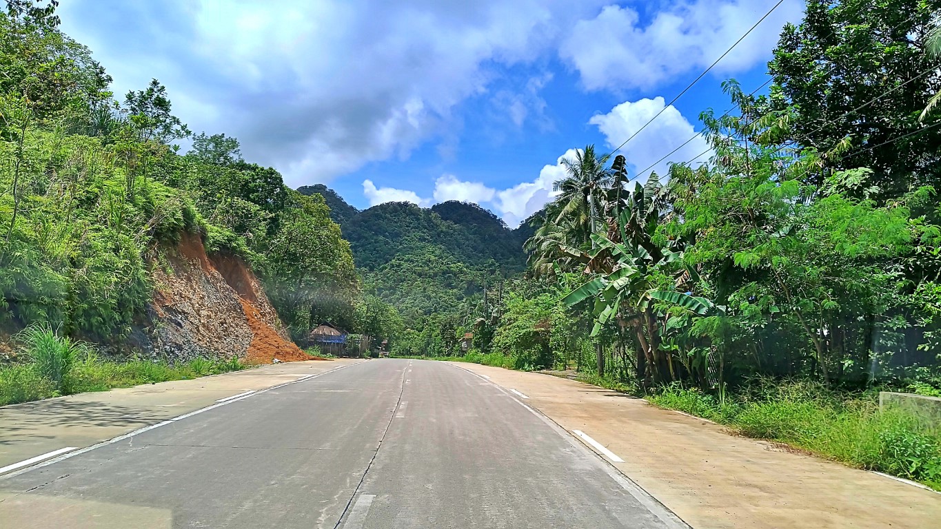 Yes hello naman Western Samar. Anyare? The Catbalogan to Sta. Rita portion of the highway was finished only in 2018 or 2019 (or was it even later?). This one, 2016 pa!
Hmm, government folks owe the Catbaloganons and Westehanons an 'explanation'. Kay ano ka-laksi maruba hit mga kalsada ha weste? Sorsogon or Leyte di man sugad!
Ngan ha este, uhu kita-a! Aba-a daw, ba-a daw... hano?! Anyway...,
Not long after (due to good roads in Eastern Samar), I already saw the big Taft river!
This DENR checkpoint is upon entering the Taft poblacion proper. Not familiar? There aren't that many such checkpoints in this country. I asked sometime ago, and I learned that it's DENR's way of probing if you're illegally taking out forest products.
That's why there aren't many you'll encounter in our country, since there aren't many protected forests anymore. They generally watchful for wood, timber or logs (daw).
But, if you take out pikóy, olót, ilahas, magô, etc., chances are makaka-lusot ka (daw), for it is hard for them to detect. Don't anymore ask what those are, they're tempting!
The important thing for us travelers is: that forest, divides east and west.
This meant I was on the Pacific side of Samar. Excitement scaled a notch higher! Going right is to the southern towns of Eastern Samar; heading left is to its northern towns; and beyond them, the Pacific Towns of Northern Samar, my final destination!
My Halfway Mark
Teka, let's mathematics ourselves! In Tagalog and Waray: Let's compute hahaha!
Time Check: 1117H at the Taft Junction (picture above). If I left Tacloban at 0729H, I was 12 minutes shy from clocking-in 4 hours on the road. About half na of 8hours.
Distance-wise: I was already 138 kilometers away from Tacloban. Wo! I was almost halfway na, of the 290km distace to Palapag. Google map says my halfway-mark is Cansangaya. Wow, it has nice white-sand beaches. I've been there when I was 10yo!
Wouldn't/Shouldn't this be a time for lunch too? Lunch is midway in one's day, di ba? No can do, they all had 'brunch' at Buray, at 9:49AM. Only I, did not. Patay tayo dyan!
And the ride goes on...
Can-avid Bridge. Dagat! Yes that's the mouth of the river, therefore the ocean na. That area with built structures at left, is town center of the Municipality of Can-avid.
Can-avid Bridge is the 3rd longest bridge of Eastern Samar at 310 meters long.
Just 3 minutes after the bridge, we were at town center and I caught this photo. I was just testing if I could catch a shot while the van was passing-by at full speed.
Just 3kms from Can-avid Municipal Hall, another big river with a longer bridge!
This Dolores Bridge is the 2nd longest bridge of Eastern Samar at 322.8 meters. Ahh the views! Dolores River turns left there, and empties also to the Pacific Ocean. I heard there are good beach resorts behind those trees - beaches facing the ocean.
Entering Dolores town proper. Marker says this place is 905kms away from Luneta!
Though briefly, the van stopped across Dolores Town Hall. I caught a glimpse!
14kms on.., a familiar place... home turf! I grew up here as a kid. This is... OrDocs! OrDocs is an acronym for Oras Doctors' Hospital - it is a reputed private institution.
I haven't been in there (simba ko!), I just snapped these photos as my van sped-by. But I know the owners, they were, are, and will always be great family friends - since forever! Oh, they also have hospitals in Borongan, Catbalogan, Dolores, Gamay, etc.!
Welcome Arch of Oras Eastern Samar. It's been standing like that for decades now. I know the architect and engineer who jointly designed (and constructed?) that arch long era ago, though I don't really know what it means or what it actually stands for.
But, it always reminds me of DPWH engineers and politicians of Western Samar. Then I silently ask: if this arch can stand many years, kayano it ira kalsada ha weste, diri ma?
Pareho manla ada ito it semento nga ginagamit!
Then I smile remembering what my friend Daniel told me: "roads are meant to have expiry dates, three years only, kay from one election to the next election la iton hira!"
Okay enough! Dahil sa Welcome Arch naalala ko lang iyang mga kalsada sa weste!
Then we approached another bridge, but the van veered left to stop and park. Why?
That's because (see white arrow below, left) Kyndra's Store is a Turbanada stop. Well, my red arrow points to the bridge identifier of DPWH, and the blue arrow, epal!
Some passengers got off, while others joined this ride here. I too got off, hoping the store would have anything heavy that resembles a meal. A sandwich would be 'fine'.
Wara! Manda a!
I wasn't really hungry yet. But I was apprehensive there would be nowhere else I can grab food until I reached Palapag. Juice ko that is about 100+ kms pa. 2 to 3 hours?
I asked driver if he'd be stopping by the market of Oras (I know there are food stalls there). He said "diri". So I got 'Fudgee Bar' (in 3 flavors) + 'Coke' from Kyndra's store.
Coke Zero in cans by the way! Yes, remote as it may be, that store has Coke Zero!
Driver still had some talk with store owners (husband & wife), so I still caught this: I don't know what that is called. Let's call him 'plasticman'. Puro plastic ang tinda eh!
And I even saw this, across the store, where the van was parked!
And finally we were off to cross the bridge, into Oras town proper and beyond... Oras Bridge is the longest bridge in Eastern Samar at 540.79 meters. It's more than half a kilometer and actually the 2nd longest bridge in Eastern Visayas (Region VIII)!
What is the longest? Of course the San Juanico Bridge.
Tivia:
Look at the photo above again; focus on the white line; engineers call it a "shoulder line" or sometimes "edge line". Now, does it mean the bridge is wider than the road?
It happens. Yata. Especially in the Philippines! Oo me ganun. Ayan na nga eh! O!
Moving onwards, turning right after the bridge, we zoomed by Oras Public Market. That is the wet market area (fish, meat, etc). Most veggies, fruits, condiments, other food items are at stalls to the right. It's a respectably good, clean and orderly place.
However, exiting Oras northwards, at Brgy. Balocawe, you'll pass by this ugly road. Ugly not because of potholes, but ugly because it is too narrow and dangerous for 4 wheeled vehicles. I'll dare say, many barangay roads are better than that. Yet, I think, that's (now?) part of the National Highway (where big buses to/from Manila pass by).
It's not even a matter if infrastructure. It's a need for discipline among residents and officials. Look at it again, pavement is nice, masikip lang. An siste, parkingan pa gu!
Ba-a kamo bawo!
I won't be surprised to hear that the area might be 'accident prone'. Where's the road shoulder? Why do vehicles park on both sides? And that's where big buses pass? Da!
A sharp blind curve, high angle slope (subida), very narrow road space, high density (population of people and stray animals - pati mga paraghubog). That is dangerous.
Anyway, onwards more beyond Oras, and in no time we reached the next town.
San Policarpo Bridge is tiny at 60 meters. Just the same it's your entry to the town.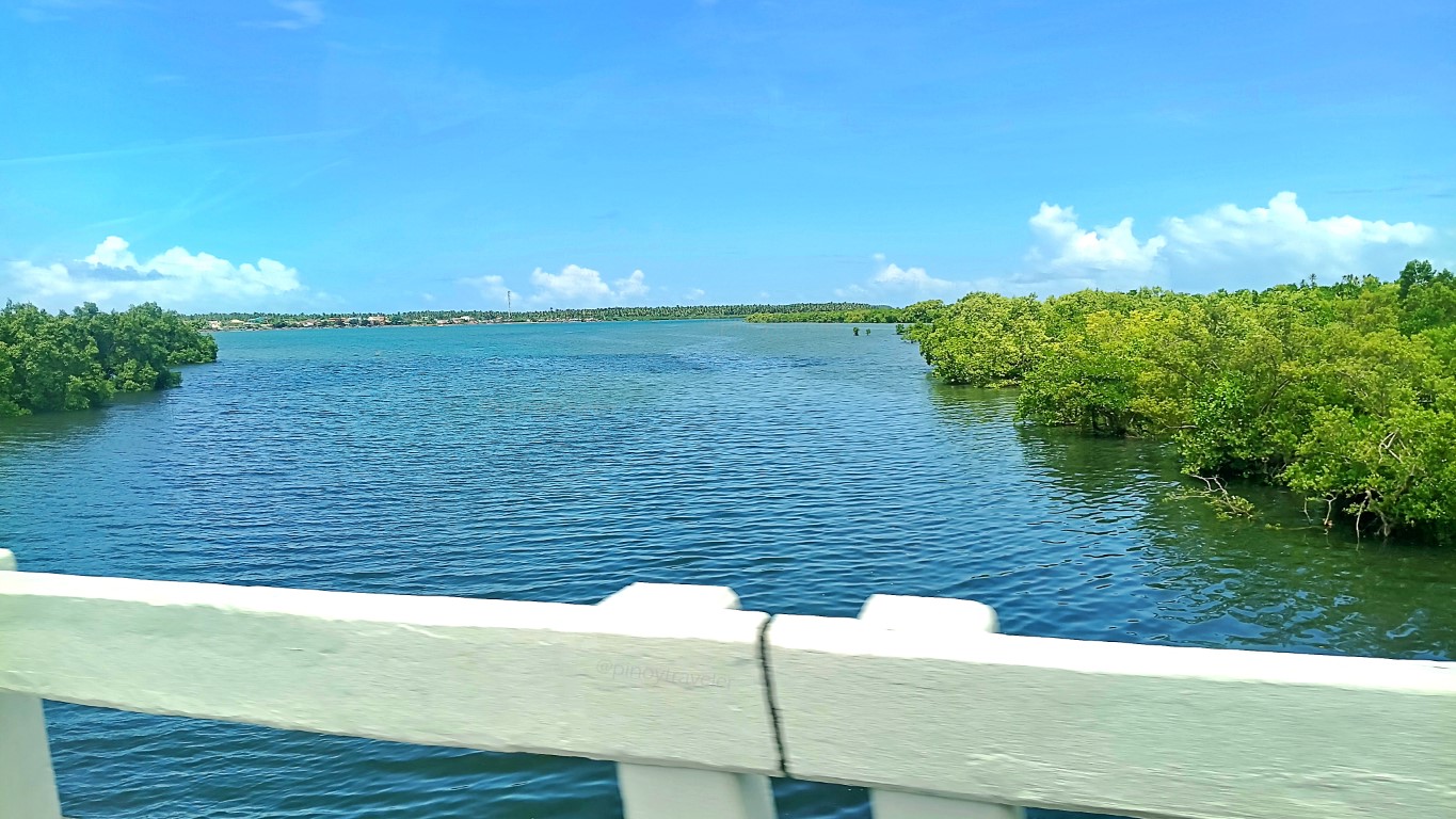 Like previous towns, the river also empties out to the sea. At left is the town center.
And also like the previous towns, the roads here are unlike Western Samar hehe!
But... there was a little battle that was difficult to fight... inaantok na ang tandership! Hmm, it must have been the sweets, and the coke, and the smooth sailing with little sways left and right. Hyperglycemia? Well, as Jason Bourne says, sleep is a weapon!
We just zoomed-by. No one got off, no joiners. Their munisipyo isn't along the way. By the way, I have observed through many years, that this town's name is "the most" mispronounced and misspelled by folks from all walks of life - nag-aral man o hindi!
It is San Policarpo. It ends with "po", not "pio". Don't worry if you're one of those who have been pronouncing or writing it wrong. Broadcasters or lawyers still do so, now!
To the consternation of the Sampolihanon, of course.
Hey, I liked seeing this welcome signage as we entered the town of Arteche... Simple yet reminder-enough for us to be serious with our use & disposal of plastics. Yes, those are softdrink bottles, filled with earth, and half-buried head-first unto that "wall". Not that they had to cut the hill for that, it's a result of the making of the road.
12:54NN, I was in-and-out of dozing off hehehe, but the mind persisted to be up and alert. I was already on the northern-most town of Eastern Samar. Palapag was near! I still had the 'presence of mind' to check on my bearings! This time I was just 4kms to poblacion Arteche - 956kms from Luneta says that dog, aw the kilometer marker!
I hope you still remember how to decipher kilometer markers. Do you?
For the enthusiasts, answer this: how's the 956 measured? From Manila to Matnog, Allen... and then? Via Catbalogan or via Catarman? Aber? Isip-isip muna, like before!
Oist, I had to (at least) take this picture, even while the van was running very fast. Behind that signage, down on the shore is a nifty-little-known but wonderful beach.
It was listed in my itinerary as an "alternate destination" should I have more time, or should I not enjoy my original plan. That's Ban-ak Beach, Brgy. Garden, Sitio Ban-ak.
In Arteche, we stopped at their pit-stop/booking office/whatever, and I saw this: Their own gas supply in Arteche? Hmm, admirable. Just like other big van transport operators. Gasoline should come out cheaper for them, due to 'economies of scale'.
What invited my curiosity though, was that thing written on their gas pumps saying: STOP "Bote-Bote". I could not ask the bontogin driver since laging naka-simangot!
So I said "hey google"! Ayun, now I know, it's a campaign. Abaw ah Popo, if you're so serious about it, why don't you just confiscate or close the little stores selling those.
Aruu, 2003 pa pala batas yan (DC2003-11-010)? Anyare? Implement!
Well, come to think of it, if I was not traveling, I wouldn't even have known that retail sales of gasoline in soda bottles is against the law. Travel is 'continuing education'!
Sige larga!
Ha, that "bote-bote" thing woke my on-and-off sleepy brain. Besides, fantastic views of the Pacific Ocean were constantly to my right as if saying "do not ever ignore us"! In case you are wondering, yes that is the Pacific Ocean. It's not a river. Most of the eastern seaboard of our country still have islets or shallows with mangrove forests.
I hope our generation and the next can keep them. That's where marine life starts.
Then I reached Catumsan, the northern-most barangay of Arteche, Eastern Samar. Its significance? Wala lang. Just a reminder for me, myself and I, that in some 1.5km I would already be crossing from the province of Eastern Samar to Northern Samar!
That boundary is at an imburnal! Yep, a box culvert on a tiny creek; the demarcation of Brgy. Catumsan Arteche Eastern Samar and Brgy. May-igot Lapinig Northern Samar. Well, what can I do? A disadvantage of commuting. I was aiming at that "boundary" (there are signboards) but the driver chose to literally jump his van on the imburnal.
Yan ang resulta. I just thought 'wag sana kami madamay kung ano man ang ipinag-hihimutok ng putanginang driver na'to! Basta 1:18PM, I have arrived, though not quite! Shoutout to DPWH Western Samar - ayan, look at the roads of Northern Samar. Why can't yours be like that? Me pumipigil ba? Ini-ibanan ba it iyo budget? Nino?! Llamar!
Anyway and yes, I have arrived at the Pacific Towns of Northern Samar, though not quite there yet - since my first layover destination among the 4 towns was: Palapag. Ganunpaman, in any case, bisan pa kon sugad... I trained my sights only to my right, because the dagat views were so inviting. Such fantastic views are seasonal & rare!
Wait wait children... I have some wicked wisdom!
Onwards, I noted the van didn't go to Lapinig's town center. It passed via the big and new bypass road. I didn't mind as I've been there and I've seen what I wanted to see.
However, somewhere after poblacion but not yet Potong, a passenger got off here. While that passenger was getting off, another white van came and stopped in front of us, purposely cutting any forward movement of our van. Its driver accosted ours.
Confrontation! I got off to smoke. Whatever the sign, I felt it was going to take time! Simultaneously another passenger told driver he was also getting off here and now.
Driver helped that young man unload his brand new, still-in-the-box bike (occupying seats 6, 7 and 8) - as he debated with driver of the white van that came to block us.
It turns out that, the young man (and his bike) were to get off at Lapinig proper, and the white van was fetching him there, so that, for whatever weird reason, they could go home to Gamay - where our van was going to pass-by anyway - in the first place.
White van driver's point: "bakit 'di ka dumaan sa Lapinig proper"? Our driver's point: "wala namang nagsabi na me bababa sa Lapinig, nagtanong ako, walang sumagot".
Our driver's fault: he sought my corroboration by saying "di ba sir, walang sumagot"?
Why was that a fault? Eh, I didn't answer. I just looked at him blankly and shrugged. In my mind I was saying "an im iroy ka daw, kaninang umaga ka pa masungit akala mo inutang namin buhay namin sayo, tas yana mapa-abuyon ka ha ak? Pag-lugaring dida!"
If he kept asking, I was ready to say all that hehe! Trained ako ni Madam Alice hoy!
That should have taught him a lesson. My turn to be "unfriendly" - kibit balikat lang!
To be honest, no one ever heard that 'young man with a bike' say he was getting off at Lapinig proper. Yet it was/is not my obligation to defend a driver with an attitude!
Not being a witness does not mean I was/am lying. Bahala kayo magkarigumok!
Kaya children... attitude! You'll never know kelan yan babalik sayo hehe!
How did it end? When some passengers told them to stop na nag cease-and-desist naman yung dalawa! [No, not me. I let them be. Nag-eenjoy ako mag-yosi sa labas].
Therefore alams na, the trip proceeded in silence hehehe. How? Well, that white van (with the young dude and his bike) proceeded in the direction of Gamay. At kami rin!
A convoy of enemies. Pwede ba yon? Pwede! It just happened first-time this-time! Not clear in the photo but the white van was there ahead of us when I took the shot.
After just about 3 minutes, here we were entering the Gamay Transport Terminal.
Some passengers got off here. I heard passengers talking, so I learned.., that buses and vans are not allowed to load/unload anywhere at center of town, to ease traffic.
We entered Gamay town proper, though just to drive-by. Yes, this is Gamay River. That bridge over there, by the mouth of the river, is (I guess) the new pedestrian and bike steel bridge opened early this year, to replace an olden wooden walking bridge.
I saw it on the news. Oh I'd love to see it up close when I come back in 4 or 5 days.
As said above, van was just passing-by since dropping-off or picking-up passengers at town center is prohibited. We even passed via the diversion road. Thus I saw this: Mika's Bukid Resort. No, not that house heheh! It's still way up and in there. A friend told me last week, that if I do visit, it's a "left-right-right" way after entering that road!
I was also told there is/was an entrance somewhere below, nearer the church. That, is all FYI, since I'm almost sure I won't go there. I am not keen on mountains or hills!
I'm a son of a beach and this is what's confirmed: I'm staying at Mika's Beach Resort their facility by the Pacific Ocean. That happens after Palapag and Mapanas - soon!
Okay forward pa more! Alas dos na! Then I accidentally saw this as we sped by: Wa! So that's the way to Araw Beach! I'll be staying there a day before I go to Mika's!
Moments thereafter the van was already cruising along Mapanas. OMG the views!
The now-getting-famous shoreline rocks started titillating and showing-off to me...
I've seen these sights 2 or 3 years ago, but that was a different circumstance...
This time I was alone looking at rock formations, walang harutan walang kulitan!
Oh rocks! Yes the rocks! And they also come from the hills and moutnains hahaha!

Oy I saw something kakaiba from Eastern Samar - lalo naman from Western Samar! I am sure you too will recognize that from the photos above. As landslide protection and prevention, they don't use synthetic or abaca nets. They use steel and concrete!
I don't know.., but I think that one is still the best hehe!
Anyway and finally.., at 2:39PM, we arrived at Palapag Merkado (public market).
And behind that public market was my final stop on this ride, the transport terminal.
Recap: how long? 7 hours and 10 minutes - inclusive of all stops - planned or not!
Worth it? Even this early, I'll say: oh yes, and indeed!
How My D-Day Started
D-Day (departure day ba!), 2 days after I went to reserve this ride, 06:51AM, I was at 7 Eleven beside the highway, waiting for a call. None so far. It was still early anyway.
If the van left their downtown terminal exactly 7AM as scheduled, it probably would take 15~20 minutes max, to where I stood at Nulatula. Not a long wait, but anxious!
Enough time for me to ransack the shelves of 7 Eleven! Marlights, seldom do hinter town sari-sari stores have that; Coke Zero, but I cannot cram those in my backpack.
I said 'let me drink at least one can before I fast on this beverage for the next few days.' Argh! But happy thoughts lang, maglalakbay tayo! Oks na, sinamahan pa ng Siopao!
I usually don't eat breakfast, but hello, this was to be a 7, 8 to even 9-hour ride. Who knows if the driver would even stop anywhere and for how long. Ang Hypoglycemia!
Alright. Exactly 0721H I got a call from an 'unidentified number'. I answered as I was dead sure it was Turbanada. It was the driver with an opening line of 'hain ka banda'.
I immediately felt this was not going to be a good start. Waray batasan. Taga huron! I politely answered anyway, as this as***** was to be beside me, for at least 7 hours.
2 minutes after that, the teller girl called, asking if their driver already contacted me. I said yes. And I waited for probably some 5 minutes more before the van appeared!
Hala Tikwang! [Let's go!]
0729H I was rolling. Yey! And exactly 0735H here we were near the EVMC.

Eh, kung ako tatanungin, I'll call it KEVMC - The Referral Hospital! K for Kawawa. Eh I heard from hurub-hurub, that is what they are heheh - overcrowded due to referrals!
Ay, marites told me, that public hospitals of the region (provincial, district, etc.) have this 'habit' of just outright referring patients to EVMC, citing this and that reason. Ta!
How convenient 'no? Their hospitals have budgets provided by the government, and all they do is refer their patients to this EVMC. Ultimo daw samad la (sugat; wound)!
An interesting topic. But I'm traveling okay? And that's not my cup of tea, really!
Let's 'move on' malayo pa ang Palapag hahaha!
A future roundabout almost done:
Meters ahead, the van approached this now well-known corner-under-repair...

Once opened, we could go to the southern end of Tacloban, bypassing city traffic.

Anticipation for the final outcome of that corner (a rotonda?), and eventual opening of the diversion road was 'hot news', until eclipsed by the sudden SJ bridge closure.
Crossing the San Juanico Bridge
I remember that closure thing was announced something like a day or two after the elections and effectivity was 15May. Disallowed vehicles lined all the way to EVMC.

That issue was why I did not ride a bus to Palapag. That is also what the Turbanada staff was telling me, that even vans took an hour or two longer. A hot SocMed topic.
Not only on social media, traditional news outfits were all at it too. The AM radio of this van I was riding was discussing the issue. So I was ready for an 8 to 9 hour trip.
Teka teka, I took a video of my experience! I'll put that here soonest. Aw eto na!
Observation: We approached the area and "joined the line" at 0737H. At 0759H, we were already past the line of vehicles, stranded buses and trucks, on the other side.
Our entire crossing experience was 22 minutes. Well, under normal circumstances, that may have been only 5 to 10 minutes. But, why is Turbanada "plus 1 to 2 hours"?
Exagg! Well, maybe I was just lucky today. I always am anyway!
Hey, I am not trying to downplay the effects of that sudden bridge limitation. I even already saw some repercussions along the way, but I will tell you about them later.
On the roads of (Western) Samar (again)...
It's been on quadmedia and every kind of social media site. The worst of roads...
Warays are quick at naming things. This stretch of Western Samar road already has many names. The ones I like are: Luxurious - meaning lukso ng lukso ang sasakyan mo; Most Holy Road - the road has a lot of holes! Other names are about politicians!
Aw let's not wallow on issues forever! I'm on tour, happy thoughts dapat! Like this:

And this was not a normal circumstance hahaha! We were at a road re-blocking area, waiting for the north-bound vehicles' green light. If he went and faced to the right, it was a very deep ravine he could fall off easily. If he went left, a cliff being bulldozed!
Let's further dissect this important Philippine Travel Phenomenon. Yes, me ganun oy!
If you were him, where would you "situate" your self? Aber? Bangin sa kanan, bangin sa kaliwa, maputik pa! How and where would you relieve your self of that quandary?
Emergency yan, did you know? Aba, pag nagpupumutok na ang pantog mo, lahat ng bagay ay hahamakin, pagkat wala ng paraan, na iyan ay pigilin! Kahit na ilang tinik...
Teka teka, bakit parang me kumakanta... ikaw ba yan?
So, if you were him, where would you face and make wasiwas your thing? Sige na, if you must face & pee on your vehicle, at which side? Tama ba yang ginawa nya? Ha?
Why not in front facing his vehicle? No one inside that fiera would see his little thing di ba? Or why not at the back, still facing their vehicle? We the people in cars behind them would not see his dark little junior, right? All we might see is his pee-shivering!
Now imagine... you're a female caught in that same situation. How'd you do that?
Hay the rigors of "long travel"! Not because the destination is far, but because roads (of Western Samar) are improperly maintained. Repairs start, only when it's too late.
Here's an interesting scene still on the roads of Western Samar. Very topic-worthy!

You see those vehicles far in the distance? They were running slow because 1) it's a downward slope of this mountain road; and 2) there are many cracks and potholes!
Eto, this is much clearer, though the SAMELCO 2 truck isn't anymore in the scene.

And, if you are driving a vehicle, light or heavy, coming down that slope from high up the mountain, would you not slow down? Baka pag-lukso ng awto mo eh... simba ko!
But happy thoughts lang... I loved looking at those loaded motorcycles! Like this:

Another nice though smirk-worthy scene of habal-habals inching up the patchy road.

Aw, Warays don't welter on ugly roads. Life must go on - including marites! Like this:

I loved this "unforgettable scene"! Epic!
What made that live tableau even more 'hilariously memorable' (to me) was that: my bontogin of a Turbanada driver honked on them several times - in quick succession!
The response: that rider at left casually waved his left hand forward, as if to say "go on ahead, overtake at this side, don't tail us" hahaha! I wanted to stand up and clap!
But I was seated in a running L300 van, beside the furious driver. Ukdum la hahaha!
Btw, if you're not 'busy' at the swaying and jumping of your car, views are grand!

Somewhere along, another re-blocking. There are a lot of these in Western Samar.

Nothing really wrong with this. There are just so many. And that, delays your travel.

Alright alright... fast forward, and we arrived Buray at 9:49AM - more than 2 hours!

I had a Siopao and a Coke Zero at 7 Eleven in Tacloban, while waiting for this van to pick me. So now, while driver and my fellow passengers ate, tunganga brigade ako?
Ah, after my BRB, I said I could guzzle a Coke Mismo. None at Shelo Jean. I roamed to all stores of Buray Junction. None. Reason: delivery trucks can't cross San Juanico.
Hasola! Nya kay 2 years kuno ang repair sa bridge. Da!
That alarmed me: this may mean I won't have Coke of any kind on this trip & back? Ta!
At least there (still) was bottled water. But I stood there a while thinking...

That was one serious personal debate I had to settle quickly, while driver and fellow passengers were still eating. OMG walang Coke? Ahaka! But, I wanted this trip more!
So, go ra!
And, lest I totally forget, I paid P1200 to the driver - as if to affirm my choice: leshgo!
After Buray (a barangay of Paranas), a long stretch of the national highway crossing the island west-to-east is still Western Samar, but travel here is usually "uneventful".
Why is that? Ah well, this long stretch of highway was made by Millenium Challenge Corporation (US Government). Being so, quality is better than what we just passed by!
Not that I advocate colonial mentality, it's about corruption in the implementation of our local road projects. Proof? This highway we are passing now (Buray to Taft) was done 2016 yet it's still a good highway as can be. The one we passed by, 2019 lang!
Vivifications (Yes me ganun in this blog!)
Phraseologic Vivification - Western Samar: We all know that's actually the old name of the Province of Samar. But in this blog (even in many news articles), I/we do use Western to distinguish it from Northern Samar, Eastern Samar and the whole island also named Samar. Reason? Kay nakaka-among hi Western - para cuentas claras la!
Photovideographic Vivification - pictures and videos during this ride mostly have an irritating reflected clutter at the bottom. I tried removing them (a brown folder, white papers, me rubbing alcohol pa) and placed them on seat #1 which I paid for. Kinuha lahat ni Driver, without saying a word padabog na ibinalik sa dashboard in front of me.
But the world must go on, di ba? So, c'mon let's go!
Into Eastern Samar
Now now.., entering Eastern Samar via the same 'cross-country' road from Buray, it's still the same good quality road made by MCC. But this thing always fascinates me:

In that process, they also do the re-blocking thing, while earth from above is pushed by gigantic bulldozers, or when they are hauling away the discarded earth! So what?
Wheh, anong 'so what' ka dyan, it's time for some 'smoking break'! Matagal yan!

As in nothing moves! Not even bikes nor people, nor the Philippine Eagle may enter! Why? That is the time when tons of earth or giant boulders are being pushed down.
Isang bagsak lang ng mga yan, malilibing ka ng buhay. You want?
Did I say Philippine Eagle? Ah yes, this is part of their habitat, their domain. They all come to this area to feed, forage or just chillax! Boring kasi pag lagi sila sa Mt. Apo!
I said this takes time. So instead of feeling bad about it, get out, stretch, smoke and watch. You are in the middle of one of the last remaining virgin forests of the country.
You probably will not be caught by that closure everytime you pass-by anyway. Plus, being at that spot, means you have been sitting for at least 36kms (from Buray), and you will still be sitting in your vehicle for the next 27 kilometers, until you reach Taft!
Any chance to stretch, grab it! Have a chit-chat with Manang Over-Over and learn!

Hey I have a tip! When Manang declares that road open, enter your vehicle ASAP:

It's a thick cloud that renders the place "zero visibility" and makes you "grey-haired"!

Ta! In this foresty area, "diri kinikita" is "engkanto"! Kulba!
Past that, it's back to good quality "old" roads (since 2016). Hello Western Samar!

Hmm, government folks owe the Catbaloganons and Westehanons an 'explanation'. Kay ano ka-laksi maruba hit mga kalsada ha weste? Sorsogon or Leyte di man sugad!
Ngan ha este, uhu kita-a! Aba-a daw, ba-a daw... hano?! Anyway...,
Not long after (due to good roads in Eastern Samar), I already saw the big Taft river!

This DENR checkpoint is upon entering the Taft poblacion proper. Not familiar?

That's why there aren't many you'll encounter in our country, since there aren't many protected forests anymore. They generally watchful for wood, timber or logs (daw).
But, if you take out pikóy, olót, ilahas, magô, etc., chances are makaka-lusot ka (daw), for it is hard for them to detect. Don't anymore ask what those are, they're tempting!
The important thing for us travelers is: that forest, divides east and west.
This meant I was on the Pacific side of Samar. Excitement scaled a notch higher!

My Halfway Mark
Teka, let's mathematics ourselves! In Tagalog and Waray: Let's compute hahaha!
Time Check: 1117H at the Taft Junction (picture above). If I left Tacloban at 0729H, I was 12 minutes shy from clocking-in 4 hours on the road. About half na of 8hours.
Distance-wise: I was already 138 kilometers away from Tacloban. Wo! I was almost halfway na, of the 290km distace to Palapag. Google map says my halfway-mark is Cansangaya. Wow, it has nice white-sand beaches. I've been there when I was 10yo!
Wouldn't/Shouldn't this be a time for lunch too? Lunch is midway in one's day, di ba? No can do, they all had 'brunch' at Buray, at 9:49AM. Only I, did not. Patay tayo dyan!
And the ride goes on...
Can-avid Bridge. Dagat! Yes that's the mouth of the river, therefore the ocean na.

Can-avid Bridge is the 3rd longest bridge of Eastern Samar at 310 meters long.

Just 3 minutes after the bridge, we were at town center and I caught this photo.

Just 3kms from Can-avid Municipal Hall, another big river with a longer bridge!

This Dolores Bridge is the 2nd longest bridge of Eastern Samar at 322.8 meters.

Entering Dolores town proper. Marker says this place is 905kms away from Luneta!

Though briefly, the van stopped across Dolores Town Hall. I caught a glimpse!

14kms on.., a familiar place... home turf! I grew up here as a kid. This is... OrDocs!

I haven't been in there (simba ko!), I just snapped these photos as my van sped-by.

Welcome Arch of Oras Eastern Samar. It's been standing like that for decades now.

But, it always reminds me of DPWH engineers and politicians of Western Samar. Then I silently ask: if this arch can stand many years, kayano it ira kalsada ha weste, diri ma?
Pareho manla ada ito it semento nga ginagamit!
Then I smile remembering what my friend Daniel told me: "roads are meant to have expiry dates, three years only, kay from one election to the next election la iton hira!"
Okay enough! Dahil sa Welcome Arch naalala ko lang iyang mga kalsada sa weste!
Then we approached another bridge, but the van veered left to stop and park. Why?

That's because (see white arrow below, left) Kyndra's Store is a Turbanada stop.

Some passengers got off, while others joined this ride here. I too got off, hoping the store would have anything heavy that resembles a meal. A sandwich would be 'fine'.
Wara! Manda a!
I wasn't really hungry yet. But I was apprehensive there would be nowhere else I can grab food until I reached Palapag. Juice ko that is about 100+ kms pa. 2 to 3 hours?
I asked driver if he'd be stopping by the market of Oras (I know there are food stalls there). He said "diri". So I got 'Fudgee Bar' (in 3 flavors) + 'Coke' from Kyndra's store.
Coke Zero in cans by the way! Yes, remote as it may be, that store has Coke Zero!
Driver still had some talk with store owners (husband & wife), so I still caught this:

And I even saw this, across the store, where the van was parked!

And finally we were off to cross the bridge, into Oras town proper and beyond...

What is the longest? Of course the San Juanico Bridge.
Tivia:
Look at the photo above again; focus on the white line; engineers call it a "shoulder line" or sometimes "edge line". Now, does it mean the bridge is wider than the road?
It happens. Yata. Especially in the Philippines! Oo me ganun. Ayan na nga eh! O!
Moving onwards, turning right after the bridge, we zoomed by Oras Public Market.

However, exiting Oras northwards, at Brgy. Balocawe, you'll pass by this ugly road.

It's not even a matter if infrastructure. It's a need for discipline among residents and officials. Look at it again, pavement is nice, masikip lang. An siste, parkingan pa gu!
Ba-a kamo bawo!
I won't be surprised to hear that the area might be 'accident prone'. Where's the road shoulder? Why do vehicles park on both sides? And that's where big buses pass? Da!
A sharp blind curve, high angle slope (subida), very narrow road space, high density (population of people and stray animals - pati mga paraghubog). That is dangerous.
Anyway, onwards more beyond Oras, and in no time we reached the next town.

San Policarpo Bridge is tiny at 60 meters. Just the same it's your entry to the town.

And also like the previous towns, the roads here are unlike Western Samar hehe!

But... there was a little battle that was difficult to fight... inaantok na ang tandership! Hmm, it must have been the sweets, and the coke, and the smooth sailing with little sways left and right. Hyperglycemia? Well, as Jason Bourne says, sleep is a weapon!
We just zoomed-by. No one got off, no joiners. Their munisipyo isn't along the way.

It is San Policarpo. It ends with "po", not "pio". Don't worry if you're one of those who have been pronouncing or writing it wrong. Broadcasters or lawyers still do so, now!
To the consternation of the Sampolihanon, of course.
Hey, I liked seeing this welcome signage as we entered the town of Arteche...

12:54NN, I was in-and-out of dozing off hehehe, but the mind persisted to be up and alert. I was already on the northern-most town of Eastern Samar. Palapag was near!

I hope you still remember how to decipher kilometer markers. Do you?
For the enthusiasts, answer this: how's the 956 measured? From Manila to Matnog, Allen... and then? Via Catbalogan or via Catarman? Aber? Isip-isip muna, like before!
Oist, I had to (at least) take this picture, even while the van was running very fast.

It was listed in my itinerary as an "alternate destination" should I have more time, or should I not enjoy my original plan. That's Ban-ak Beach, Brgy. Garden, Sitio Ban-ak.
In Arteche, we stopped at their pit-stop/booking office/whatever, and I saw this:

What invited my curiosity though, was that thing written on their gas pumps saying: STOP "Bote-Bote". I could not ask the bontogin driver since laging naka-simangot!
So I said "hey google"! Ayun, now I know, it's a campaign. Abaw ah Popo, if you're so serious about it, why don't you just confiscate or close the little stores selling those.
Aruu, 2003 pa pala batas yan (DC2003-11-010)? Anyare? Implement!
Well, come to think of it, if I was not traveling, I wouldn't even have known that retail sales of gasoline in soda bottles is against the law. Travel is 'continuing education'!
Sige larga!
Ha, that "bote-bote" thing woke my on-and-off sleepy brain. Besides, fantastic views of the Pacific Ocean were constantly to my right as if saying "do not ever ignore us"!

I hope our generation and the next can keep them. That's where marine life starts.
Then I reached Catumsan, the northern-most barangay of Arteche, Eastern Samar.

That boundary is at an imburnal! Yep, a box culvert on a tiny creek; the demarcation of Brgy. Catumsan Arteche Eastern Samar and Brgy. May-igot Lapinig Northern Samar.

Yan ang resulta. I just thought 'wag sana kami madamay kung ano man ang ipinag-hihimutok ng putanginang driver na'to! Basta 1:18PM, I have arrived, though not quite!

Anyway and yes, I have arrived at the Pacific Towns of Northern Samar, though not quite there yet - since my first layover destination among the 4 towns was: Palapag.

Wait wait children... I have some wicked wisdom!
Onwards, I noted the van didn't go to Lapinig's town center. It passed via the big and new bypass road. I didn't mind as I've been there and I've seen what I wanted to see.
However, somewhere after poblacion but not yet Potong, a passenger got off here.

Confrontation! I got off to smoke. Whatever the sign, I felt it was going to take time! Simultaneously another passenger told driver he was also getting off here and now.
Driver helped that young man unload his brand new, still-in-the-box bike (occupying seats 6, 7 and 8) - as he debated with driver of the white van that came to block us.
It turns out that, the young man (and his bike) were to get off at Lapinig proper, and the white van was fetching him there, so that, for whatever weird reason, they could go home to Gamay - where our van was going to pass-by anyway - in the first place.
White van driver's point: "bakit 'di ka dumaan sa Lapinig proper"? Our driver's point: "wala namang nagsabi na me bababa sa Lapinig, nagtanong ako, walang sumagot".
Our driver's fault: he sought my corroboration by saying "di ba sir, walang sumagot"?
Why was that a fault? Eh, I didn't answer. I just looked at him blankly and shrugged. In my mind I was saying "an im iroy ka daw, kaninang umaga ka pa masungit akala mo inutang namin buhay namin sayo, tas yana mapa-abuyon ka ha ak? Pag-lugaring dida!"
If he kept asking, I was ready to say all that hehe! Trained ako ni Madam Alice hoy!
That should have taught him a lesson. My turn to be "unfriendly" - kibit balikat lang!
To be honest, no one ever heard that 'young man with a bike' say he was getting off at Lapinig proper. Yet it was/is not my obligation to defend a driver with an attitude!
Not being a witness does not mean I was/am lying. Bahala kayo magkarigumok!
Kaya children... attitude! You'll never know kelan yan babalik sayo hehe!
How did it end? When some passengers told them to stop na nag cease-and-desist naman yung dalawa! [No, not me. I let them be. Nag-eenjoy ako mag-yosi sa labas].
Therefore alams na, the trip proceeded in silence hehehe. How? Well, that white van (with the young dude and his bike) proceeded in the direction of Gamay. At kami rin!
A convoy of enemies. Pwede ba yon? Pwede! It just happened first-time this-time!

After just about 3 minutes, here we were entering the Gamay Transport Terminal.

Some passengers got off here. I heard passengers talking, so I learned.., that buses and vans are not allowed to load/unload anywhere at center of town, to ease traffic.

We entered Gamay town proper, though just to drive-by. Yes, this is Gamay River.

I saw it on the news. Oh I'd love to see it up close when I come back in 4 or 5 days.
As said above, van was just passing-by since dropping-off or picking-up passengers at town center is prohibited. We even passed via the diversion road. Thus I saw this:

I was also told there is/was an entrance somewhere below, nearer the church. That, is all FYI, since I'm almost sure I won't go there. I am not keen on mountains or hills!
I'm a son of a beach and this is what's confirmed: I'm staying at Mika's Beach Resort their facility by the Pacific Ocean. That happens after Palapag and Mapanas - soon!
Okay forward pa more! Alas dos na! Then I accidentally saw this as we sped by:

Moments thereafter the van was already cruising along Mapanas. OMG the views!

The now-getting-famous shoreline rocks started titillating and showing-off to me...

I've seen these sights 2 or 3 years ago, but that was a different circumstance...

This time I was alone looking at rock formations, walang harutan walang kulitan!

Oh rocks! Yes the rocks! And they also come from the hills and moutnains hahaha!


Oy I saw something kakaiba from Eastern Samar - lalo naman from Western Samar!

I don't know.., but I think that one is still the best hehe!
Anyway and finally.., at 2:39PM, we arrived at Palapag Merkado (public market).

And behind that public market was my final stop on this ride, the transport terminal.

Recap: how long? 7 hours and 10 minutes - inclusive of all stops - planned or not!
Worth it? Even this early, I'll say: oh yes, and indeed!
#EasternVisayas #TravelPhilippines #SamarIsland
11 12 13 14 15 16 17 18 19 20
21 22 23 24 25 26 27 28 29 30
31 32 33 34 35 36 37 38 39 40


Comments
Post a Comment