Oh Pilar!
After Sierra Bullones, we headed east to the town of Pilar. I thought my driver said "Bilar", that is why I said okay, yung meron man-made-forest? He immediately corrected that saying noo sir, that is Bilar, B as in Boy, we are going to Pilar, P as in Papa! But I instead replied with ahh okay, akala ko B as in Girl!
Tawa sya. I'm a good co-pilot. I provide entertainment, kung hindi rin lang ako mismo ang nababagot!
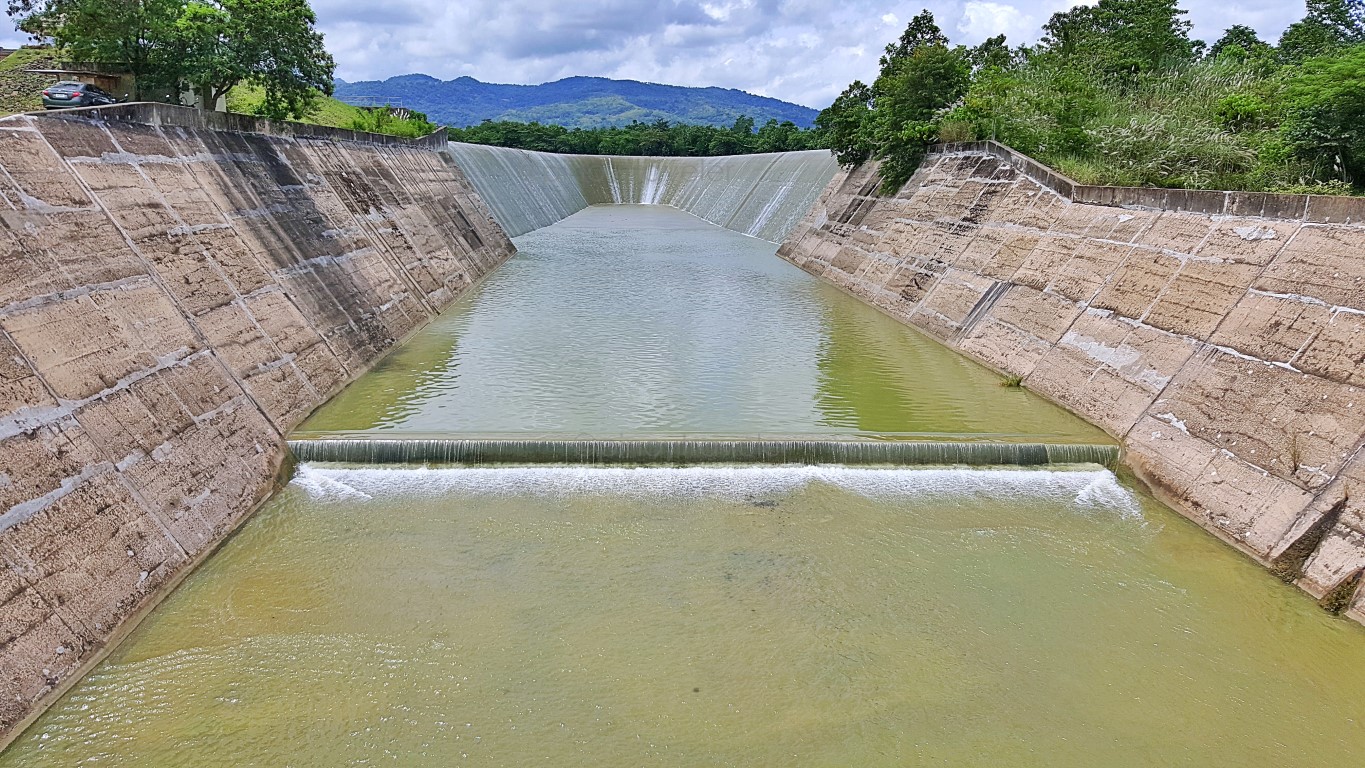
But only about 2 or 3 kilometers on this onward ride out of Sierra Bullones, we passed by this...I exclaimed "whoa what is that, can we stop here"? Guess what? As he told me that that is the spillway of Malinao Dam, he also stopped the vehicle, right where we were -in the middle of the bridge- mismo!
Oh eh, I went down for a better vantage! I just said to my self "the wonders of driving in the provinces"!You can park anywhere you want, including on a bridge! I took that photo with the car door even open. No, we were not in some picnic grove. We stopped and parked in the middle of a bridge, on a highway!
I learned new things here, thanks to my driver/guide. This is the Wahig Bridge, where we stood...The bridge crosses Wahig-Inabanga River which was dammed. Teka, why do I sound like I'm cursing? Bakit para akong nagmumura? Okay, checked that. I said "dammed", not "damned"! Just making sure!
I did not ask, but driver/guide told me of information, that triggered the inquisitive (a.k.a. atrevida) me! Such as? Such as there's another "Wahig Bridge" upstream at still Wahig River but in Sierra Bullones. I asked if we passed by it, he said no as it is way south, but just about 200 meters behind the giant kid!
I asked where Wahig River starts, he said way up the mountains south of Sierra Bullones near the area of the Eskaya settlements. I also asked where this ends, he said 'at Inabanga', after first passing other towns like Dagohoy and Danao. Wow, this river actually diagonally cuts Bohol southeast to northwest.
I asked more... if Wahig River starts to be called Wahig-Inabanga River from this point to downstream, why is this bridge not called Wahig-Inabanga Bridge (so it would be different from the Wahig Bridge at Sierra Bullones to avoid confusion). He said "ah yan sir, di ko na alam" hahaha! Honga naman, I'm so..!
Back to where I was.., I asked why is the dam called Malinao Dam, when it is over the Wahig or Wahig-Inabanga River? Driver/guide was already smiling dryly everytime I asked. Hmm, maybe I was already being ridiculous. Yet, he still answered with "maybe one of the tributaries is a Malinao River or creek"!
Alright, while pointing to that slope (see picture above), he told me that's the "parapet wall", while that flat area on top, which is also a road or promenade is called the "crest" of the dam. Whoa! Those were new technical terms to my ears! Thanks to this guide who obviously did research! Travel is education!
That made me recall that I have been to parapet walls of other dams, like here, here and here, but only this time did I think of "what if those walls break"? Hiyay! As my guide say 'wala na, goodbye earth' na.
Anyway, I was already there, so I walked up to see the dam up close. To the right, after the bridge, is a wide parking space and a row of eateries that were altogether blaring deafening videoke sounds! So I called out to my driver/guide, telling him to get his vehicle off that bridge (siga eh) and park properly!
Hey, I did shoot a video clip while walking around. I'll put that here soon. Promise!
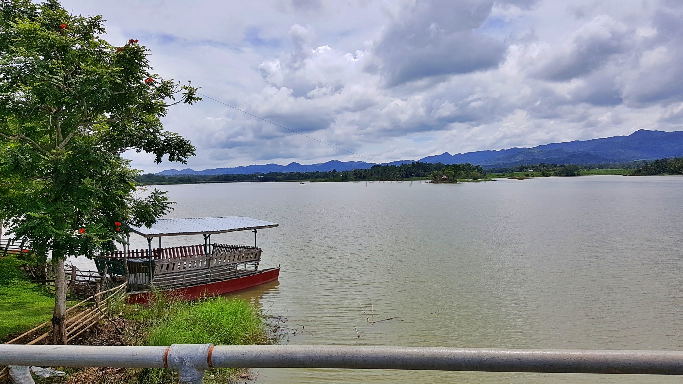
Up at the dam's crest, it's like "a park with a nice laid-back view of a lake" created by this Malinao Dam.You can rent "floating cottages" and enjoy your picnic "in the middle of the lake". There are kayaks too.
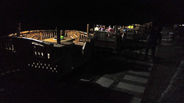
There are also these open-type day-use picnic cottages that you can rent, just like at beach resorts!If you didn't bring your own picnic food or drinks, that's no issue. Just walk up to the eateries and buy. They deliver to this area! It's a walk away, but somehow out of range from the blaring videoke sounds!
Beautiful place? Ah well, I do think so. But, my driver/guide's comments would probably summarize it, to put our expectations in proper perspective. He said we were lucky to have passed-by where there is water"! This was the only time he saw that spillway with water, probably because this was September.
He says, for most of each year, this dam is literally dry, that people can go down and walk on the river (lake) bed. Nge! That its purpose to help in irrigation of rice fields was not realized, as it also dries up during summer months, and for most of the year. That this has even been investigated by the senate.
Da! And OMG! Need I say anything more?
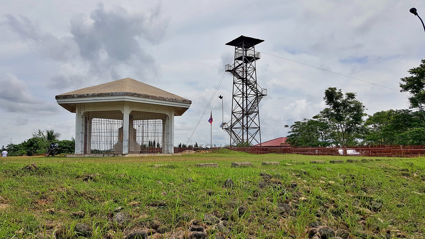
I asked what this tower is for. He said that was the jump-off point of a zip-line that folded in no time! Curious, I asked why the zip-line closed. He laughed and said "walang tao, pangit ang view"! I said "but I like the views as they are now". Which he readily answered with "ngayon lang, kasi tag-ulan, alangan namang mag-zip-line ang mga tao kung nag-kiki-kidlat, nag-kuku-kulog, at umuulan"! I agree heheh!
Then I asked about that nice-looking gazebo with some kind of monument inside. He said "ah marker lang yan". That intrigued me. A "marker lang" but in the form of Magellan's Cross enclosure (though a bit smaller) with the floor and 'monument' all made of marble, and 'grilled' all over too? Ah, I went near.
That marble thing is tall, probably 7 or 8 feet, it has three sides with nothing but names. JUST names!Names of what? Hah, names of people involved in making this dam a reality. Napamura na talaga ako when I read them, and I said "tangina, ipangangalandakan lang ang mga pangalan nila, ginawan pa ng marmol na bahay"! That is being "epal" to the penultimate. An expensive marble house just for names.
Let us assume (just for the sake of discussion) that this dam is/was a success, that is still blatantly a waste of resources, erecting such a building just to "immortalize" the names of public employees. Eh yun na nga, sablay pa! Okay sana if the money spent on that monument came from each of them. Eh inutang ng Pilipinas yan sa Japan, at babayaran ng pera galing sa lahat ng mamamayan. Yes tangina!
And they even had the nerve to put spot-lights shining on those bronze slabs - as if in a museum or art gallery. Plus, they even fenced/grilled that whole thing off, as if the slabs or their names are treasures.
Who are they anyway? Ah, on one side of that thing (I think we should better call them epitaphs!) are names of the BOHOL IRRIGATION PROJECT STAGE 1 MANAGEMENT AND STAFF. Another side has the BOHOL PROVINCIAL, NATIONAL AND LOCAL OFFICIALS. Then the third side has the NATIONAL IRRIGATION ADMINISTRATION BOARD OF DIRECTORS and MANAGEMENT AND PDI STAFF. Shame!
Well, if anything, it is somehow good they caged their names in there. To be preserved and hopefully seen by their families and relatives, hanggang sa mga apo nila, that any name appearing in there was involved in such a shameful waste of the country's money. May all be remembered na huwag tularan!
Haizst! Uminit ang ulo ko! But I recovered with a bright idea, and my driver/guide agrees! I said "dapat nga naman pala alagaan at ingatan ang bantayog na yan. Pero dapat lagyan ng malaking karatula na nagsasabing THE MALINAO DAM PILAR BOHOL HALL OF SHAME! Guide said "sige ako i-post sa FB!
Haay hehehe!
Anyway, we proceeded to enter the town center of Pilar, passing through this picturesque road.I naturally exclaimed "ang ganda"! But, my driver/guide seemed to disagree by saying "ang labas lang, pero ang loob, walang gamit". Obviously, he was not yet over our talk about the dam's gazebo hahaha!
But I thanked him for educating me that that is called a "parapet wall", topped by a road called "crest".
Then I went again... asking "what if that wall breaks and gives way"? He laughingly replied saying "aw wala na, patay kang bata ka, goodbye earth na"! Hahaha, I don't want to imagine that. But, it happens, right? Simba ko, hwag naman sana kahit saan sa Pilipinas. Horrible disaster yan! Oh, my driver/guide had the last word saying "'di mangyayari yan dito sir, eh wala ngang tubig palagi eh". I rested my case!
About 2 or 3 kilometers on, we reached a public market and the church beside it. But it was drizzling.I said I won't anymore go down, but we could see that its name is Virgen Del Pilar Parish Church. My guide says that it has seen so many renovations like expanding it to the sides for additional seats. But when I asked why it seems to be out of the center of town, and beside a public market, he didn't know.
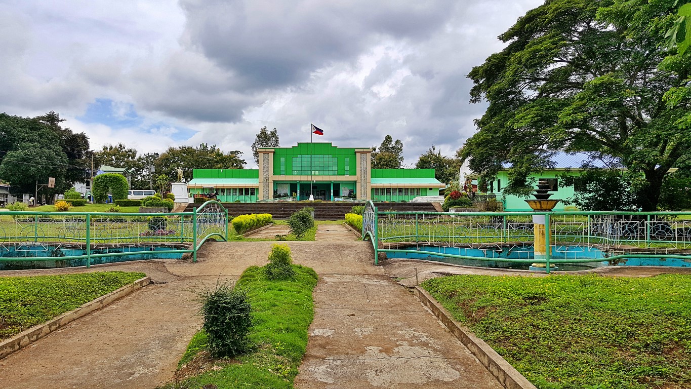
So we drove on, amid a sparsely populated part of town, about a kilometer until we reached this...That is the municipal hall of the town, and I said wow! It sits in a big park with big trees and greenery everywhere, but it was raining! Argh! Driver suggested we wait it out a little while in the car, so we did!
But when the drizzling lightened a bit, I got out of the car, ran into that little bridge, and took this...Of course I immediately ran back into the car! That photo was good enough for me to remember Pilar!
Driver drove around a bit, even under the rain, and we both wondered "where are the houses for this to be called a town"? There are even no real residential streets parallel to the main road. The few houses we saw at center of town, even at their public market and church areas, are by the side of the highway. Nothing much behind them! But this isn't a new town (proclaimed in 1961 by President Garcia). Hmm.
Palaisipan! So I thought.., wouldn't this be a nice retirement haven? 急ぐ おじいさん hehe, sugod! Just saying hehe, kasi napansin ko, mas type ng retirees yung medyo laid-back, rural, small population. Ito!
Anyway, we rolled onwards, going northeast to Alicia, as driver says it's about 20kms. Then I saw this:I said I am familiar with that kind of color and structure. It's a KOICA project. I saw something like that in Digos and near the Iloilo Airport area. Driver said "ah RPC yan sir". But I asked what really is an RPC.
Now I know.., it's a Rice Processing Center, complete with "dryers", "mills" and even "storage facilities" all within a single roof or a single compound. WOW! That means no more waiting for the sun to come out and shine! No more bilad-bilad sa highway that hampers traffic! That's an awesome thing to have!
고마워 한국! Yes, kamsahamnida! Even if I don't know if it was just given or a loan hehe.
I wish there would be more of that in Cagayan Valley and the Nueva Ecija - Bulacan areas. Halos kasi buong biyahe mo eh palay ang ginugulungan ng sasakyan, kasi nakalatag sa semento! Eh let's accept that, the Filipino driver will still slow down while trampling over palay, since they say "aba grasya yan"!
I like the idea of that RPC thing, really - even if I am just a mere traveler. It helps not only the farmers, it also helps in efficiency of land travel! Sige sige, maglagay nyan sa Bicol, sa Gandara Samar, sa Ilocos!
Oh by the way, before we go too far, my driver/guide told me that the towns we just passed (Carmen, Sierra Bullones) up to Pilar and Alicia are top rice producers. And Bohol is the rice capital of Region 7.
And we laughed loud when he said "lalo na kung ayos sana ang irrigation galing sa Malinao Dam"!
Okay okay.., tama na 'yang dam topic na yan!
Anyway, we were on our way to Alicia, so let's proceed. But in my next story, k?
K!
===
11 12 13 14 15 16 17 18 19 20
21 22 23







Comments
Post a Comment