Alluring Alicia
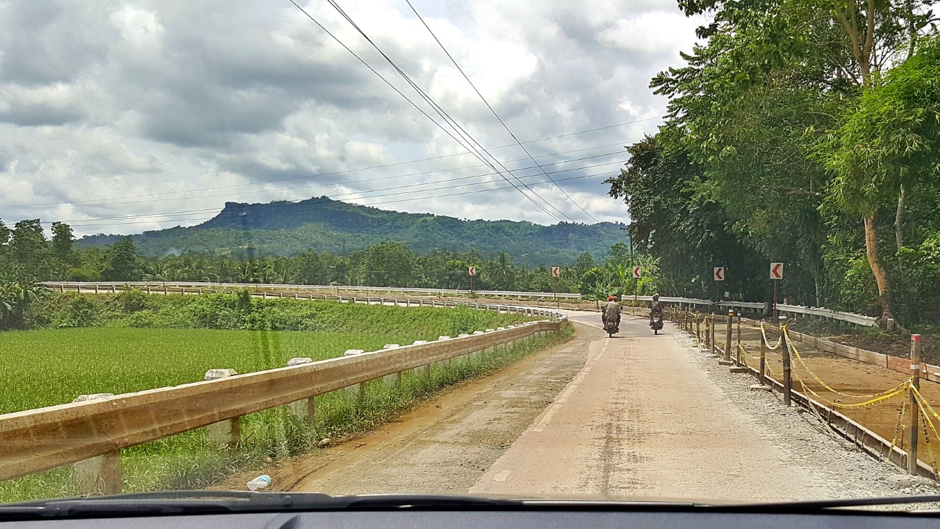
The drive from Pilar to Alicia is about 20kms, or somewhere near that. It continues on vast rice fields, with a view of hills in the distance. However, at about 5kms before the town center of Alicia, the road starts a smooth gradual climb, and the hills start being nearer the highway. This is a picturesque road!
Many of those hills and mounds are of the shape, size and topography of the chocolate hills. They are mostly devoid of big trees, but green with grass or shrubs. And, the road starts to undulate nicely too!
Then there is a "T Junction" where turning left is to Ubay, while turning right is to the center of Alicia.You will already see hints of the most famous Alicia attractions (yes, plural) - the grassy, tree-less hills that tourists hike to, for awesome panoramas of the surrounding lowlands. There are many such hills.
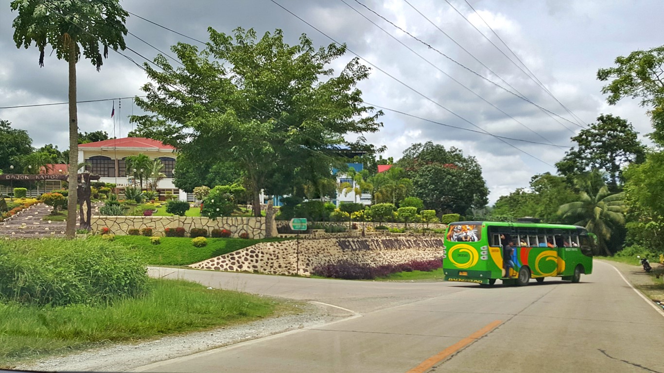
Arriving into center of town, first to attract my attention was the municipal hall. However, the terrain in this area is so uniquely uneven my driver/guide couldn't find any street space to stop and park his car!
So we agreed that he briefly stop at a corner to let me off, and I walk to the municipal hall and plaza.Well, we did not know, the technique is to circle around the plaza/park/gardens, follow the little road up to the municipal building itself and park right in front of it! Not easy to guess, as everything looks like a garden only for pedestrians - narrow concrete paths with flowering plants on both sides. Aliw!
Interestingly 'kakaiba'. That is why, my driver says, many Boholanos refer to Alicia as their "highlands"Not really totally "highlands" since my altimeter says we were just something like 53ft above sea level. But the grounds at which they erected their municipal hall and gardens has that kind of mountain feel!
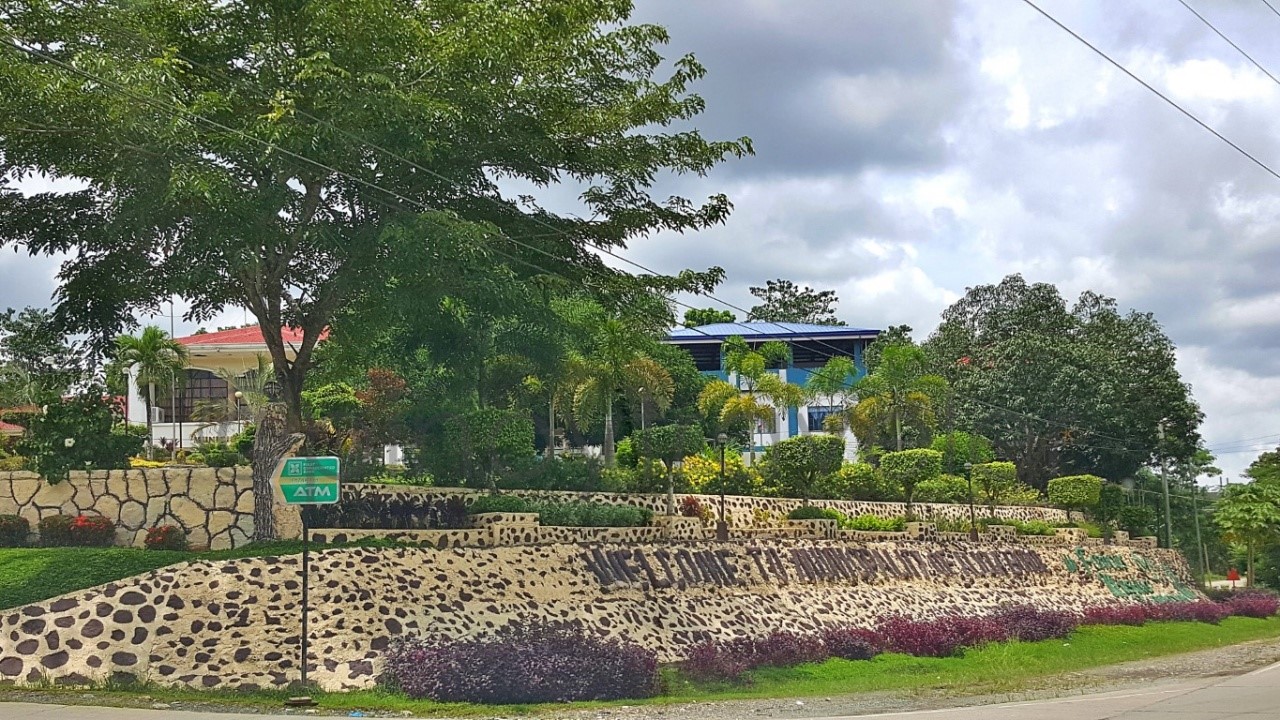
By the way, those writings on that wall say "Welcome To Municipality of Alicia Bohol" and towards the end, in green color, the phrase says "Famous Musika Kawayan". Yup, they're noted for that kids' group!
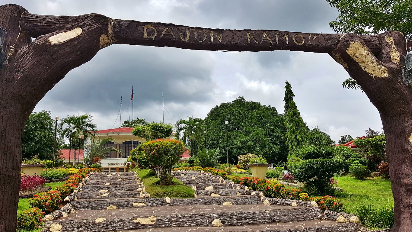
So I walked in the middle of the park (well, yes it's a "climb", actually), going up to the municipal hall."Dajon Kamo" written on that rustic-looking arch (that's painted concrete) generally says "Welcome". It is "Dayon Kamo" in Cebuano, or "Tuloy Kayo" in Tagalog. In English it literally says "Come On In, You"!
Hey, while the letter "J" is usually pronounced as "H" or sometimes "Y" in most of the Philippines (due to our Hispanic and other western influences); in Bohol, there are words where "J" retains its English writing and pronunciation. An example is 'dajon' [pronounced: da-jon, never da-hon]. Another is 'waja'.
Do note, they don't apply that "rule" universally to all "J" cases. Just to some words. For example, they still write Maribojoc but pronounce it ma-ri-bo-hoc or Jetafe/Getafe as he-ta-fe, just like the rest of us!
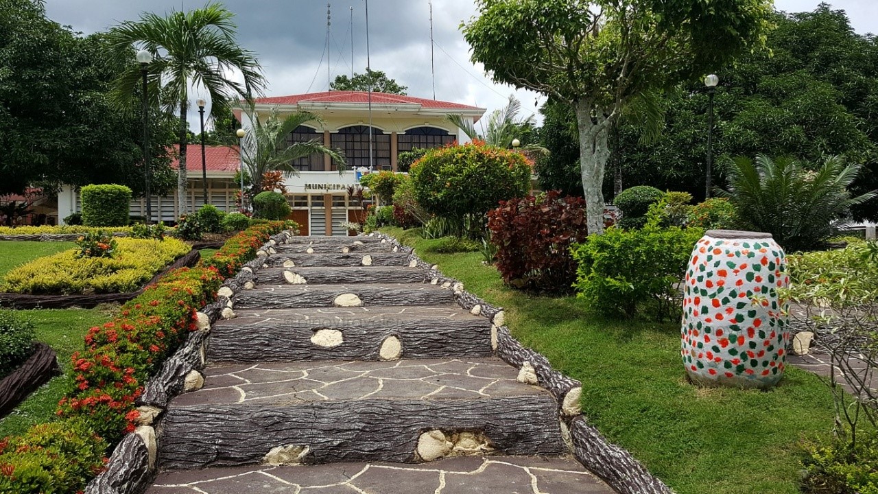
So I continued my way up. This is a nice park, full of plants, trees and flowers, obviously well-tended!Not only instagrammable, I guess you can even do pictorials or shoot pre-nuptial videos here!
And this is their Municipal Hall. It's in an elevated area overlooking the highway and some residences.Civil office buildings like the police, fire, disaster, engineering, RHU, assessor etc. are on both flanks of the edifice. What's in that main block? Ah, maybe just the mayor and sanggunian offices. It's tiny cute!
Turning around in front of the municipal hall, this is one of the refreshingly cool views...That snippet of a road is the highway. Notice that it curves, but you can't see that it also slopes down!
The vehicular way going up to the municipal hall building (behind me as I took the above photo), is via a street that looks to be part of the park, just below those Indian Trees at right. Notice though, that it's not a through-street. It's a dead-end in front of the police building, you may find it difficult to turn back!
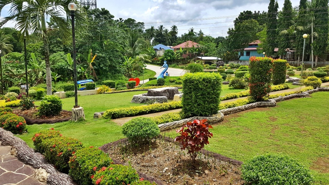
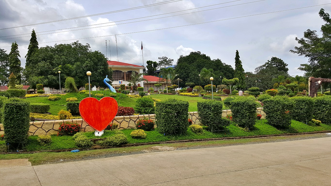
Back down at highway level, I still turned around for another pic of the park/gardens. Ang ganda eh!Can you see the head of a blue peacock? Yep, just a head. The body and tail are probably being left to our imagination! Maybe the grass, plants, flowers arranged around it are supposed to help us do that!
Even that, I now find as a bright "public art" idea!
Is that a peacock or a pheasant? What is its significance to this town? Is it extinct or threatened? Is it an endemic species to Alicia? So I asked my guide, and he said he does not know, but will ask around!
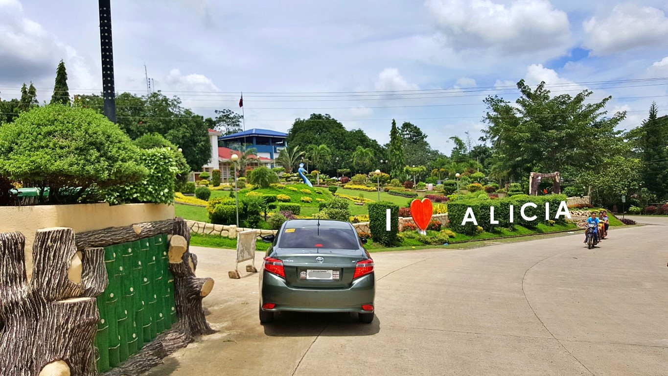
Oh, one more thing on that park.., you of course see that red heart on foreground, right? Do you notice that there are box-like bushes beside it? I just saw that their wire-mesh frames are formed like letters!
Yes, those are viny bushes that crawl on a frame. The frames they are supposed to grow into spells:I 💓 ALICIA. Yup, just for fun, I took liberty at putting the letters on that picture for us to visualize their intention. So that's how it's done pala! You first let the bush grow, then you cut the leaves and twigs, to form letters/shapes, just by following the contours of your wire-mesh frame. Woh, ang galing nila 'no?
How did I find that out? I just accidentally happened to see one of the wire-meshes (for letter A) while taking pictures. Maybe, at the time of my visit, they were still waiting for the bushes to grow thicker so next an expert (is it called a "topiarist"?) can come to cut them into letters - a la Edward Scissorhands!
I enjoyed looking around this municipal hall area and park. Driver/guide says maybe we were lucky as it was still the rainy season, such that the trees, plants and flowers were all abloom. Well, maybe yes, but that still confirmed what I earlier told him, that I do not really have to hike two hours up the hills, to see caves, waterfalls and panoramic parks (usual Alicia tourist spots), just to say I loved Alicia haha!
Yes, he told me about those attractions, including what is called the "Alicia Schist" (oldest rock?), but those things are maybe too complex, complicated or profound for my lowly mind, as of now anyway!
So I asked where might their church be. Hinanap, nagtanong - because it is not anywhere in sight, as is common with other towns! On the way there, 2 or 3 blocks from the municipal hall was their public market, but we couldn't pass-through as there was something like an on-going parade or procession.
We went another way to that church as told to us by locals, which they said was another 2 or 3 blocks. But alas dimalas, it looked like the 'event' was also going that way. In fact, the front portion seemed to have already arrived there. Ah! So, instead of waiting, we decided to proceed instead to the next town!
Exiting town center, my driver/guide did fill me in on more Alicia trivia. I liked the "how the town got it's name" story. It's an interesting tale, that I think should be titled "how to make sure you get an audience with the president of the republic" circa 1940s, at least hehehe! And the tall story goes something like:
In the 1940s, a group of leaders (politicians) from this place campaigned for the barrio of Batuanan to be declared a separate town once again - after having been a barrio, then a town, then back to being a barrio again during the American occupation. That request needs approval of the Philippine President.
They saw an opportune time to plead with the then president of the country (Elpidio Quirino) who was then in Dumaguete, by "ambushing" him with a plea that their barrio be declared a town, to be named Alicia, in honor of said president's wife, who at that time was just recently killed by Japanese forces.
They weren't part of the president's agenda while in Dumaguete. But, if your were (the new) president of the republic, suddenly confronted with a proposal, honoring the name of your wife, who along with your 3 children, died while fleeing the "Battle of Manila", what would you feel and what would you say?
Syempre, approved in principle! Thus, when Quirino returned to Malacañang, the request was inked!
And that was how barrio Batuanan became a town named Alicia. That was mighty cleverly cunning of those politicians! They hit the soft spot "middle and center"! Ni-tuhok sa kasing-kasing! Yeah, tagos sa kaibuturan ng puso ni President Elpidio Quirino, lampas pa nga yata hanggang atay! Bulls-eye 'tawon!
So, this town's name of "Alicia" is in honor of Alicia Syquia Quirino. It is the same 'name source' as the town of Alicia in the province of Isabela, and the town of Alicia in the province of Zamboanga Sibugay.
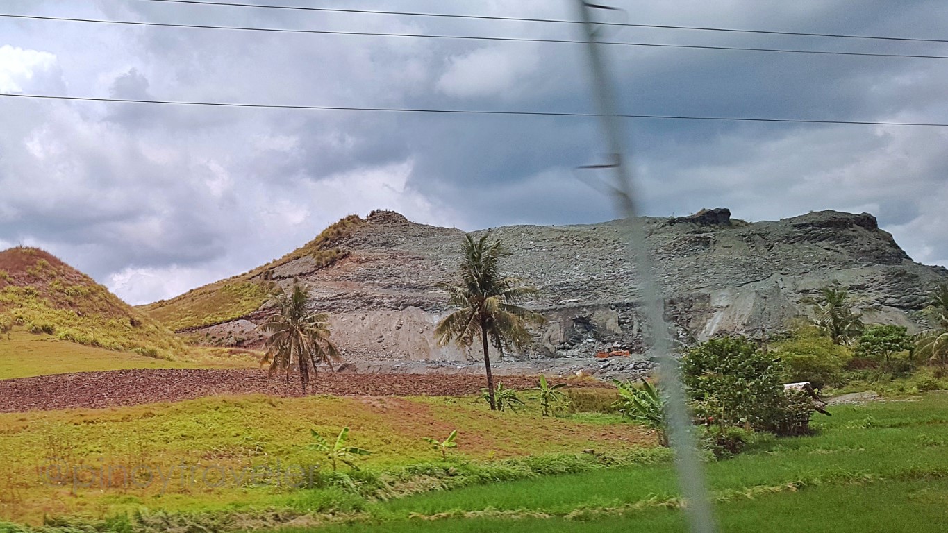
Anyway, on our way out of Alicia, just 2kms going southeast, I saw some of those familiar hills again:The one at right is obviously being quarried. My guide said it probably crumbled, cracked, or caved-in during the 2013 mega-quake, thus being quarried nalang, to ensure safety. But the cute little mound at left edge of the picture is, for all intents and purposes, a Chocolate Hill, right? Surely that is not part of the count, as this is far (50kms?) east of what we usually refer to as "The Chocolate Hills" in Carmen.
Alright, the next town, Mabini, was near at probably just a little more than 10 kilometers from Alicia.
But let's talk about that in my next 'installment'. C ya!
11 12 13 14 15 16 17 18 19 20
21 22 23


Comments
Post a Comment