Bacayaw Resorts Cove, Llorente
Another nice find for me! I didn't know this is such a wonderful place, until I curiously went to find out!
Here's my story...We were 'speeding' back to Tacloban (haruy, @80kph max) from Borongan (the blue arrow's direction) when I saw that signage again (yellow arrow). I have seen that board, about a resort, many times now.
Seeing that it was still a little early at just past noontime, I asked the driver to turn back, for us to have a quick look and see at whatever that place may be. That would be the red arrow, still in the pic above.
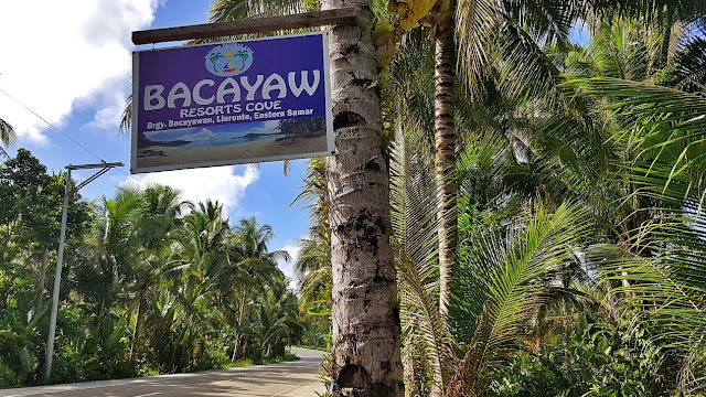
While turning off the highway unto the dirt path, I took this picture of that signboard once and for all!So I came to know it is named Bacayaw Resorts Cove. That board also told me this is still in Llorente! I have always thought this was already part of Hernani since this corner is just a few kilometers to the new Hernani Municipal Hall. I always thought of that board as "that resort in Hernani" ayayay sorry po!
Anyway, so we drove on this pathway, to whatever is/was supposed to be Bacayaw Resorts Cove..,I said we were going "too slow, make it a bit faster"! Maybe I was too excited to see what was in there. Driver did not answer, but concentrated, looking intently at what his vehicle was trudging on. Probably just being extra cautious that this dirt road could have hazards. This path is about 300 meters long.
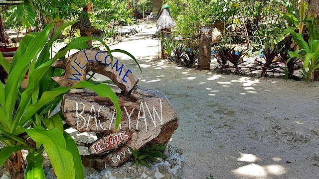
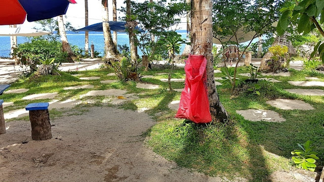
We eventually finally arrived anyway.., and this is where vehicles park, and people enter walking.., It's basic, simple, primitive (a.k.a. "rustic"), but I like it. It makes me feel I am with real beautiful nature.
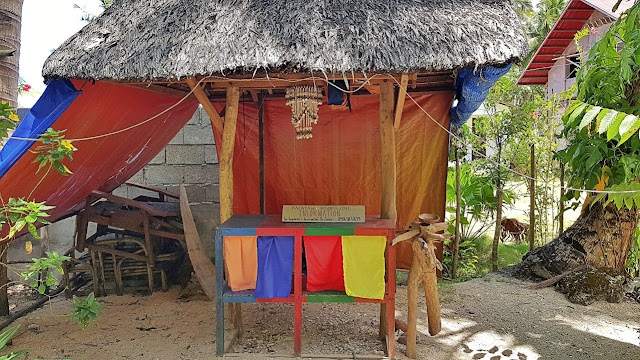
Reaching the middle portion of the resort's grounds, we stumbled upon this little hut..,Although unmanned during our arrival, this looks like the "front desk" and/or "information desk"!In fact, I wondered why we were the only visiting humans on a fine Saturday noontime of summer!
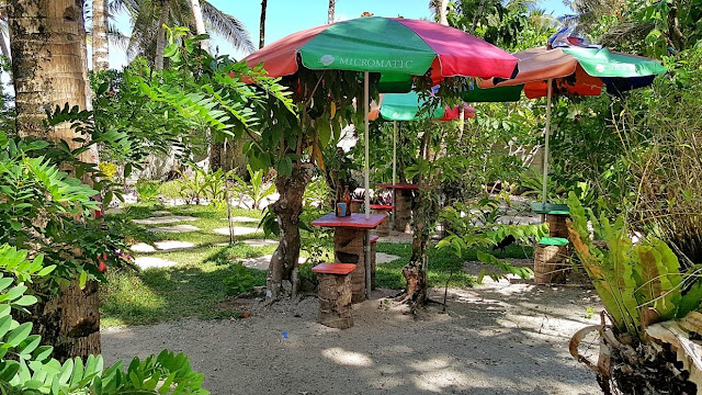
Here are more photos as I roamed around this little rustic patch of paradise in the Pacific! The white squares on the grass that may look like tile slabs on some of the photos above are actually sand that they placed like so, and I am still perplexed (until now that I write this) as to why or what for.
AND NOW.., I saved the best for last!
Let me pull that picture from the top of this article, to show the cove, which is this..,While the shoreline looks 'exaggeratedly' curved (because that's a panoramic shot), this place is really like so. What I would like to call a "perfect cove", if there is something like that! But here's more: out in front, about 500 meters from where I stood, those two promontories are connected by a coral seabed.
It is shallow at that whole stretch, so the big pacific waves break and stop there, making a lagoon out of this expansive inner area. It thus becomes an expansive but placid natural seawater pool, very ideal for any kind of water-borne activities. That is probably 500 to 600 meters wide (left to right) and about 500 meters far from this sandy shoreline to the shallows up front where those big pacific waves stop!
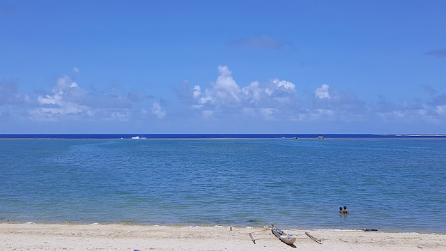
I even saw a fisherman walking on that shallow frontage, and I could see the waves behind him..,Look at the middle line of the photo. The white lumps you see near the center are waves crashing into, and stopping at that 'coraline barrier'. A bit to the right are rocks, nice for your instagrammable poses!
From that natural wave barrier out there, all the way to where the kids are playing near a 'banca', is but an immensely placid seawater pool that is (probably) safer than your usual pacific-facing oceanfront!
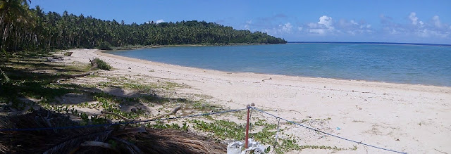
How do we go to that "barrier" up front? Well, if not by banca, I guess one has to walk by the shore..,This was the view to my left. The white sandy beach stretches just to a few hundred meters, although I could see its far edge connects to the coral barrier. A shoreline worth exploring a bit further, I guess!
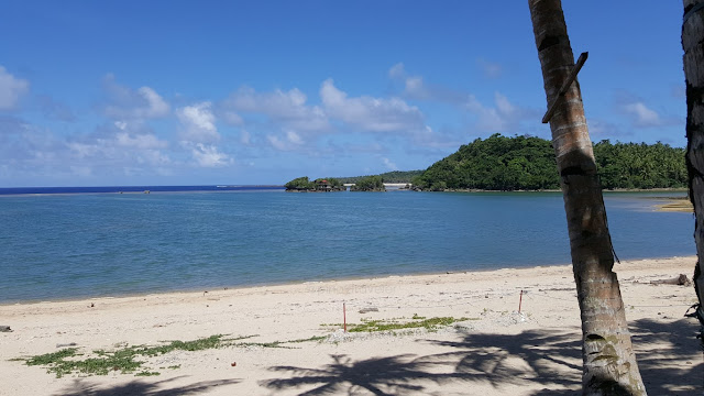
To the right, the wide white sands do not also seem to stretch all the way out to those islets..,Just the same, there seems to be a 'walkable' way to that "barrier" where the waves splash or smash!
Aha.., I shot a short video clip panning around this lagoon. I'll put that here soon.
Anyway, still about that right side edge of this cove, I noticed there's some kind of "development"..,Yep, there is a sizeable structure on one of the three rocks, and it looks like more of a vacation house. Or probably even a resort? Ah, my nosy brain could not take this sitting down. I needed to know more!
So I learned that..,
I also learned that..,
Oh wow! I have never previously heard about these paradises I just stumbled upon!
Here's my story...We were 'speeding' back to Tacloban (haruy, @80kph max) from Borongan (the blue arrow's direction) when I saw that signage again (yellow arrow). I have seen that board, about a resort, many times now.
Seeing that it was still a little early at just past noontime, I asked the driver to turn back, for us to have a quick look and see at whatever that place may be. That would be the red arrow, still in the pic above.
While turning off the highway unto the dirt path, I took this picture of that signboard once and for all!So I came to know it is named Bacayaw Resorts Cove. That board also told me this is still in Llorente! I have always thought this was already part of Hernani since this corner is just a few kilometers to the new Hernani Municipal Hall. I always thought of that board as "that resort in Hernani" ayayay sorry po!
Anyway, so we drove on this pathway, to whatever is/was supposed to be Bacayaw Resorts Cove..,I said we were going "too slow, make it a bit faster"! Maybe I was too excited to see what was in there. Driver did not answer, but concentrated, looking intently at what his vehicle was trudging on. Probably just being extra cautious that this dirt road could have hazards. This path is about 300 meters long.
We eventually finally arrived anyway.., and this is where vehicles park, and people enter walking.., It's basic, simple, primitive (a.k.a. "rustic"), but I like it. It makes me feel I am with real beautiful nature.
Reaching the middle portion of the resort's grounds, we stumbled upon this little hut..,Although unmanned during our arrival, this looks like the "front desk" and/or "information desk"!In fact, I wondered why we were the only visiting humans on a fine Saturday noontime of summer!
Here are more photos as I roamed around this little rustic patch of paradise in the Pacific! The white squares on the grass that may look like tile slabs on some of the photos above are actually sand that they placed like so, and I am still perplexed (until now that I write this) as to why or what for.
AND NOW.., I saved the best for last!
Let me pull that picture from the top of this article, to show the cove, which is this..,While the shoreline looks 'exaggeratedly' curved (because that's a panoramic shot), this place is really like so. What I would like to call a "perfect cove", if there is something like that! But here's more: out in front, about 500 meters from where I stood, those two promontories are connected by a coral seabed.
It is shallow at that whole stretch, so the big pacific waves break and stop there, making a lagoon out of this expansive inner area. It thus becomes an expansive but placid natural seawater pool, very ideal for any kind of water-borne activities. That is probably 500 to 600 meters wide (left to right) and about 500 meters far from this sandy shoreline to the shallows up front where those big pacific waves stop!
I even saw a fisherman walking on that shallow frontage, and I could see the waves behind him..,Look at the middle line of the photo. The white lumps you see near the center are waves crashing into, and stopping at that 'coraline barrier'. A bit to the right are rocks, nice for your instagrammable poses!
From that natural wave barrier out there, all the way to where the kids are playing near a 'banca', is but an immensely placid seawater pool that is (probably) safer than your usual pacific-facing oceanfront!
How do we go to that "barrier" up front? Well, if not by banca, I guess one has to walk by the shore..,This was the view to my left. The white sandy beach stretches just to a few hundred meters, although I could see its far edge connects to the coral barrier. A shoreline worth exploring a bit further, I guess!
To the right, the wide white sands do not also seem to stretch all the way out to those islets..,Just the same, there seems to be a 'walkable' way to that "barrier" where the waves splash or smash!
Aha.., I shot a short video clip panning around this lagoon. I'll put that here soon.
Anyway, still about that right side edge of this cove, I noticed there's some kind of "development"..,Yep, there is a sizeable structure on one of the three rocks, and it looks like more of a vacation house. Or probably even a resort? Ah, my nosy brain could not take this sitting down. I needed to know more!
Voila, how timely! My driver ordered SanMigLight (for me) and some chips (for him). And those things arrived just at the very time I was pondering about my questions above. I am not sure if he is/was one of the owners or caretakers, but a man who brought our orders knew some answers to my questions!
So I learned that..,
Yes that is a rest house nestled on one of the rocks, but being contemplated by its owners to become a resort; That indeed, you can walk to that shallow coral barrier that face the waves - but faster to row a boat going there; That some local residents also call this cove as the "Blue Lagoon'; That this place is in Brgy. Bacayawan, Llorente, Eastern Samar; That he does not really know what "bacayaw" means!
I also learned that..,
Behind both promontories (left and right) are also strips of white sandy beaches that aren't yet known even to many local residents; More importantly (in case you thought I didn't notice).., the white beach that can be seen behind those three rocks is part of Kalipayan Beach - a 3km long strip of white beach stretching from Brgy. San Jose, in Llorente all the way to Brgy. Canciledes in Hernani - and beyond!
Oh wow! I have never previously heard about these paradises I just stumbled upon!












Comments
Post a Comment