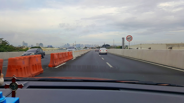
I passed by NAIA-X
As if this is anything worth shouting to the whole world about, ano? Bear with me the probinsyano. I knew this was being built, but it's not everyday (anymore) that I hear, much less see and pass by, the traffic wonders of the metropolis! There are none of these twists at where I usually am, these days!
So okay alright, I arrived at NAIA Terminal 2 and hailed Grab Car. As the ride went on, driver asked me where I wanted to pass: "sa old domestic road o NAIA-X". I exclaimed "aba, bukas na yun? sige let us pass there"! I learned, drivers need to ask this question, as there's an extra toll that you'll have to pay!
It climbs a rampway after the gas station (before the corner that turns right to the domestic road) at a place I remember to be 'six eleven' (Pildera). I recall this was a flood-prone area, so goodbye baha na!
Then it goes to the height of the highest level of 'Park-N-Fly' building, then there's a fork in the road (up there), where going straight is to Macapagal Ave. or Cavite, while turning right is to Terminal 3 or T3.
Then it runs parallel to the Domestic Road. I think this is above what once was Baclaran River. Next it turns right just like the road below, passing by private hangars like those of Air Ads and A. Soriano, the PAL hangars, and voila, goes into the then Nichols/Villamor Airbase (now NAIA T3) and New Port City.
From there it connects to the skyway. Aba, mahusay! A real EXPRESS way!
Well, that said, I can easily get really lost in these new crisscrossing elevated highways. Example: if I was going to New Port City, should I have exited going to T3 or not? Oh, I saw a u-turn slot in front of Holiday Inn, but it looked jammed. Trapik pa rin?! I think Waze and/or GoogleMaps aren't yet updated!
Anyway, that was a good find. Driver told me this part of NAIA-X (Terminal 2 to 3) opened just 3 weeks ago. It took 9 minutes from T2 to the front of T3 and New Port. And that was about 5kms! Wowness!
Pwede!


Comments
Post a Comment