On The Way To Sabang, Puerto Princesa
Which Sabang is this? Ah, good you asked, because there are many places named Sabang all over the Philippines (Luzon, Visayas and Mindanao)! There's even also a Sabang in Banda Aceh, Indonesia. Da!
The Sabang that's in our topic today, is the one in Puerto Princesa. And don't just say "puerto", as there is also a Sabang in Puerto Galera, Mindoro! This Sabang I am talking about is the jump-off point to the famous "Puerto Princesa Subterranean River National Park" commonly known as "underground river"!
This Sabang, is actually even just a sitio of Barangay Cabayugan, Puerto Princesa City in Palawan. But it is now well-known to travelers, and getting to be a big commercial settlement, owing to its being the only safe and comfortable jump-off point for tours going to the underground river. Its not near though!
Sabang is only 75kms from Puerto Princesa's city center. But it takes from 1.5 to 2 hours (or more) on a private vehicle and on a good road. Why? Because there are many other things to see along the way!
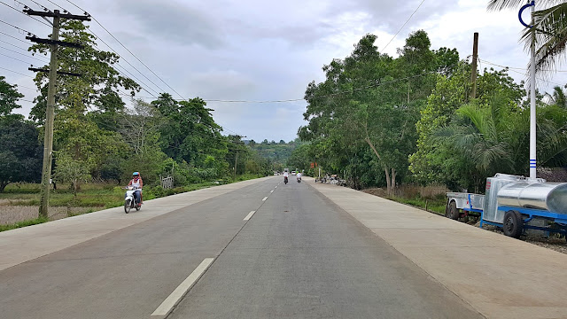
Oh, that photo above is already nearing the intersection going to the Sta. Lourdes Wharf that we went to yesterday on our Honda Bay Tour. This was possibly 10kms after dropping by Aziza Paradise Hotel.
Aha, it might be good to tell you now, why we dropped by Aziza (some 1km behind Robinson's Place).
It was like this: we checked-out of Purple Fountain Courtyard Inn early in the morning as we departed for the Underground River Tour, because we would be checking-in at Aziza Paradise Hotel upon return late in the afternoon from that tour. And as said in that previous story, this was by design (on purpose) per our travel itinerary [because we chose Aziza for a birthday celebration of one of our companions].
Our purpose in passing by Aziza, on our way to Sabang, was perchance to drop (deposit) some of our bags not needed at the underground river tour. Because if not, we would be leaving those bags inside our vans parked at the Sabang Port for 3 hours, surely, the drivers can't be watching them all the time.
Without listening to our reason for requesting (plea actually) to deposit our bags, the Aziza front desk girl automatically said "no". Her reason: "you are not yet checked-in". Argh, it was futile pleading with a mere desk clerk who wouldn't budge, and won't also "produce" her manager that we wanted to talk to!
In short, we wasted precious tour time passing by Aziza with an inconsiderate desk clerk. We all know big and real hotels have space and are more than happy to accommodate such requests. I even once sent my luggage via courier to my hotel in Macau, and it even arrived a day ahead of the physical me!
Even our tour guides were disappointed at that front desk clerk. Anyway, our drivers, who had already been with us for the 3rd day (today), promised to watch our things in their vans as we toured the cave.
Okay, back to my story on the road (we'll talk about more of Aziza later). I tried to enjoy the moment..,
And the "topic" within each, and between our two vans (we were communicating via toy-walkie-talkies and/or cellphones) was hilariously about Mr. Urinating Kojak haha! Wasn't he able to hold it any more longer, or was it a matter of habit being an ignorant bastard (taga-bundok)? We all had a mighty laugh.
Ah, on any trip, just enthusiastically open your senses, there will always be something fun or funny!
Anyway, some 5 or so minutes on, past the intersection towards Sta. Lourdes Wharf, I saw this..,
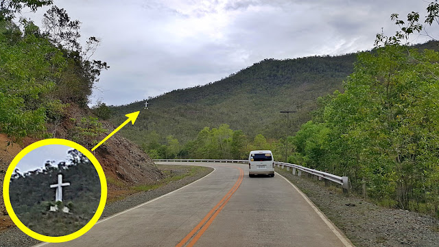
Richie is a mountaineer by the way, and he continued telling us that: "Magarwak" is actually the name of that mountain (range); that it is an easy and fun trek going to that cross (built in late 2004); that the cross stands not even halfway to the mountain's summit where there is a fantastic panoramic sunrise view of Honda Bay and the many islands scattered in it, including those we visited in yesterday's tour!
I (tried, pretended to) enthusiastically exclaim "wow".., but inside my lowly brain I was actually saying: "bundok, aakyat, easy daw.., wheh, kayo nalang, I'll stick to the beaches and the town centers" hehehe!
Actually, while the Magarwak topic went on, the newly-paved highway kept climbing mountain ranges with panoramic views! We were still on Palawan's east side, but west side snippets started appearing.

I noticed, there are now a number of view decks along the highway to enjoy the panoramic scenes..,

Many non-Filipino visitors I have spoken with, are actually surprised (some annoyed) why the fees for such vantage points. Well, let us just say, that is the way of third world countries. You even pay to use (not necessarily clean) public toilets. So where do all the people's taxes go? Hmm, ask the legislators!
Although if you were on a guided tour (by legitimate tour agencies), you don't (can't/won't) necessarily stop at all those view decks that you see everywhere, unless you vehemently demand to do so! Why? Well, it is usually because they have already studied and planned what combination/s of sights to see would be best for you (according to them) in relation to available time and expected activities for you!
Of course, it is said 'tour guides receive token amounts from establishments they bring us to' - just like anywhere else on earth, right?. But they don't make it too obvious, and still plan worthwhile itineraries!
Like, we did not stop at that viewdeck above, but we still saw the views even as we zoomed through!

Then we reached this very important intersection.., a place called "Salvacion Junction"..,

By the way, I just learned during this trip that, from this corner to Barangay Bahile on Ulugan Bay, is the shortest paved-road distance (about 5kms) from the eastern to the western seaboard of Palawan. Do be aware though, its just from one side to the other. Sabang is still some 38kms also from this corner.
Now now, as said above, this "Salvacion Junction" is very important to those adventurous enough who want to do a DIY travel to Sabang. Why? Because, from Puerto Princesa's city proper, you may actually ride on commuter vans or jeeps going to the northern towns like Roxas, San Vicente, Taytay, etc., then get off this corner and wait for those going to Sabang. Same if you're coming from those north areas, even El Nido. No need to go all the way to Puerto Princesa proper. Just get off at Salvacion Junction!
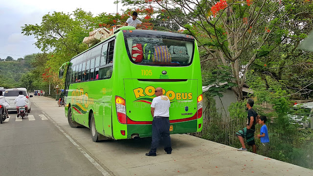
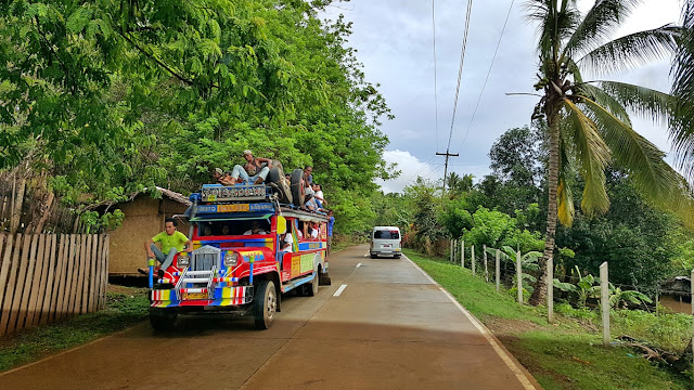
Here's an example of the jeeps that ply the Sabang - Puerto Princesa (and vice-versa) route..,
Here is something worth checking out, for you my philanthropic/humanitarian-minded readers..,

Palawan Conservation Corps is a non-profit non-government organization (NGO) that fosters (mainly) the development of out-of-school-youth (OSY) of Palawan, geared mainly towards care for the area's environment. Those dorms are where the kids stay (gratis), during their 6-month in-residence training.
Aren't you curious what they learn (become) after 6 months? I am. Sige, let's research pa more!
Anyway, here's another intersection, and we technically officially reached the western side of Palawan!
The most notable thing about this intersection (for me) is that monument of a bird - a peacock..,
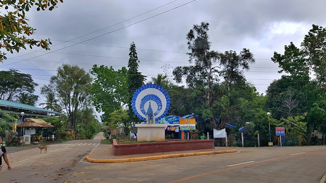
I asked why the "rebulto" is colored white and sky-blue! Richie laughingly told me that it is probably for any number of aesthetic purposes hehehe! Oo nga naman.., the (real) bird is generally brownish-black to hazel with electric blue (neon-like turquoise) lines and circles on its plumes. Where do you find that kind of paint color? It must be expensive! Besides, it won't register well for visibility of the monument!
Okay na?! Okay fine. The important thing is they are able to showcase something that is important not only to this island but even to the whole planet. The monument should remind us all, that this bird had once been on the endangered species list. Kudos to the efforts of concerned global organizations and scientists, it has now been relisted as 'vulnerable', though that means its existence is still 'threatened'.
A few kilometers onward, the road was at sea level, we were passing by the waters of Ulugan Bay..,

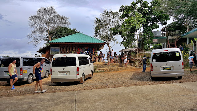
A little bit more onwards and we reached the good old (original) viewdeck on Palawan's west side..,

The Buenavista Viewdeck. A "Scenic Overlook" says this carved wooden signage..,

Good that there were not too many tourists yet when we arrived.., but starting to fill!
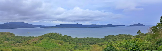
This is what the view deck was made for.., a panorama of Ulugan Bay. Spratly Islands behind those!
A sustainable tourism project of the barangay (Buenavista), and was already like so a decade ago!

Of course their little store has grown big and wide with many things on sale other than snacks!

And the big green plastic trash bins of a decade ago are still around.., OMG wow!

A bit across that view deck (btw) starts appearing the interesting-looking karst hills and mounds..,

And we entered Brgy. Cabayugan with a dizzying array of signage here and signage there!

But for the adventurous wanting the less beaten paths.., activities can already be had in this area..,

Depending on the type of trek that you choose, you can have an encounter (a visit) with the Tagbanua Tribe somewhere in those mountains! But, Richie tells us, prior arrangements are necessary for that.
Anyway, for those (like me) who are not into deep jungles, your curiosity may also be perked by this..,

Here's the wonderful part.., our guides told us that the said resort even built accommodation cottages in the middle of that organic farm - which - probably means guests can live and experience that whole farming thing, if not (yet) now, maybe soon! Hmm, okay Sheridan, bucket-listed! Looking forward to it!
Another interesting thing: if you have sharp, eagle-eyes.., look, there are huts at the base of that rock!

Onwards, I saw directional signage to "Daluyon", a luxury resort our guide said is one of the best..,
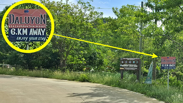
Intriguingly, the resort's name "DaluyoN" (Tagalog word Daluyong, without the G) comes from a rather unnerving phenomenon that means [storm]surge or 'big wave' or 'tidal wave'! One would immediately think about the devastation that Yolanda/Haiyan brought, right? But this ASEAN Green Hotel Standard 3X Awardee resort already had that name, years before that killer "storm-surge" wrecked the Visayas!
Oh hey, this simple-looking bridge has something to tell that not many tourists are being told about!

Does that mean you/we can sail through this river (from this point) going to the subterranean portion? Technically yes, but, we might have to become as minute as molecules at some areas to be able to do just that haha! Not to mention that, it would probably take us more than just a day tour on a van hehe!
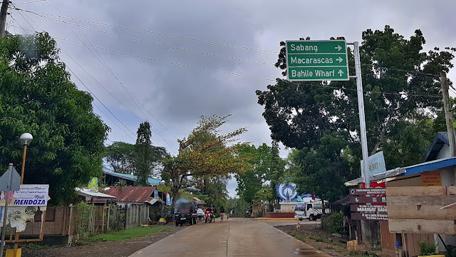
Alright, let's move on 5 kilometers forward, and we reached this getting-to-be-famous intersection!

And by he way too, some meters before that Sheridan corner (behind the camera) is THE other corner on a similar private road that leads to the main entrance of Daluyon Beach & Mountain Resort. Ganun!
Anyway for the rest of us mere mortals, the road goes onwards (derecho lang) to Sabang Wharf!
Eto o, you get to see a number of "epal" advertisers competing to 'welcome' you into Sabang. Haruy!

But there are interesting things to see along the way, even if you are not entering luxury resorts!

Then there is this big catholic church. I mean really BIG for a mere "sitio" or "purok" that is Sabang!

Let us not dispute that, we have no right hehehe! They have the money, they build a big church, period! And that is called the Santuario de San Jose Marello. So, it's not a church but a "sanctuary"? Oh my St. Joseph ama ni Hesus, what is it really? Ah, forget canonical nomenclatorial politics hehe, it's a church!
So is it a parish? Aba ewan ko, but chances are... it is not (yet hehe)!
Update:
A blogger-friend called me to state that it might really not be a church but "just" a chapel. Nabuang na ang kalibutan ayayay! Eh my dictionary even says a "chapel" is just a "small room". Building baga iyan! We instead just laughed anyway, when I ended this with "chapel does not actually appear in the bible"!
Then we entered the "main strip" of Sabang - actually the only street (if we can even call it that)!

See this? There is even already a three-storey building (at left-corner) care of the national police!

It now really looks like approaching the Caticlan waterfront of the late '80s to early 1990s when there was no airport yet. Although to me, during this approach, it felt like I was entering the ferry terminal of Sibulan, or even the gate of Simala Shrine - meaning.., kung hindi pa man, nagbabadya na ang traapik!
Look, there were no road repairs when we passed-by this corner, but there were those obstructions..,

The tents at right are booking and boarding terminals too, of some of the commuter vans that ply the routes not only to Puerto Princesa, but to other places too such as Port Barton, El Nido, San Jose, etc.
After that bend above, we finally reached our van's destination - the green arrow I drew on this photo!

You see the people where my red arrow points to? Those are the crowds that, like us, were waiting for their boat rides to the underground river! And the blue arrow? More people also waiting for boat rides!
And.., we finally really arrived at the Sabang Boat Terminal to catch a boat to the underground river!

To manage your expectation though.., by reaching this wharf, you are not there yet hahaha! In fact, my distance tracker says it is still about 6 to 7 kilometers travel on the West Philippine Sea (did you know that?), and according to the good memory of my lowly brain, is not always on a calm tranquil blue sea!
But let's talk about that in my next story!


Comments
Post a Comment