Minasangay Island
If you are into cliff-jumping, cliff-diving or rock-diving whatever these are now called, this place named Minasangay Island may just be your ultimate getaway. It's an island but no need for boats going there!
It is an island yes, but very near mainland that you just cross a little bridge and walk climb jump swim your way to/at various spots of the island for a unique respite! This is in Balangkayan, Eastern Samar.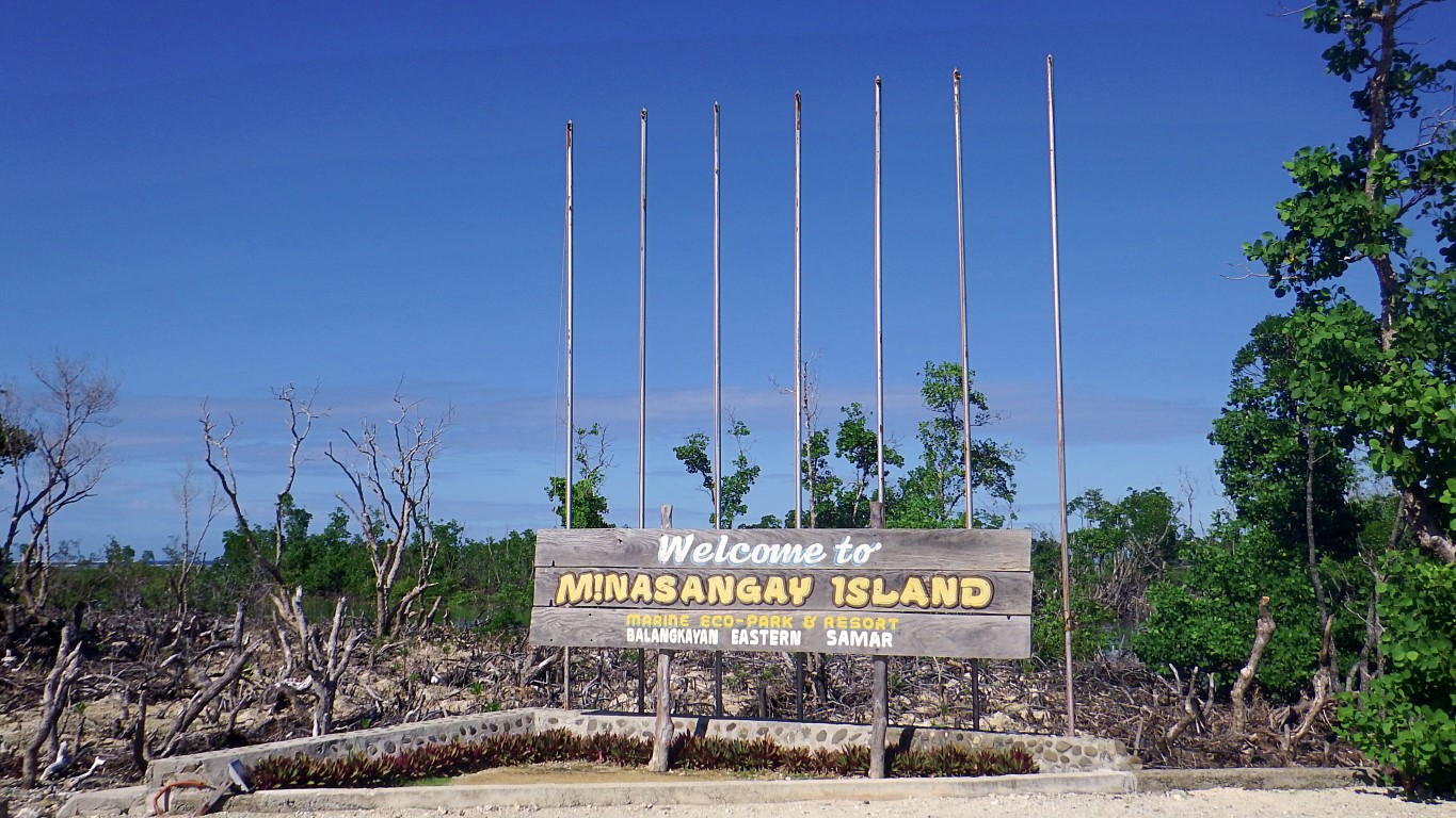 The island is made of white sand and rocky limestone cliffs, kissed by the great blue Pacific Ocean. It is surrounded by dead and (still)alive mangrove forests. The dead "bakhaw"-look are so eerie-looking!
How did I know and how have I gotten to this place anyway? I kept seeing this signboard on the road! So this afternoon, on my way from Borongan to Tacloban I once and for all asked the driver that we go check the place out. To satisfy my itchy feet always intrigued by that signage na naaagnas na nga eh!
This is to the east of the highway, and entering the service road I said "parang magandang lugar ah"!
But as we moved on.., my mind wanted to switch hehe! I wanted to say "parang hindi maganda ito ah"! Why did I think that way? Because, as you can see, they seem to have "killed" a lot of mangrove trees.
Onwards though, I had second thoughts. It looked like the dead mangroves aren't a man-made thing. It is just too wide. Even at those that had nothing to do with the road, the trees are also dead. Ano ini?
So okay, I told my big-mouthed brain "hep hep, hold your comments or criticisms, you are not yet sure of what really happened here". So, nagsitigil nga si ako! And we arrived at the entrance to Minasangay.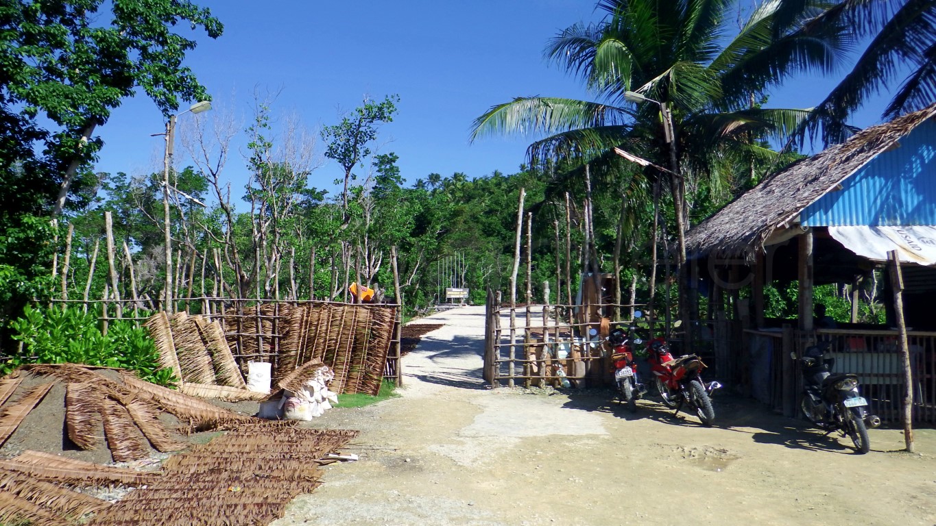 In that hut is where you pay the entrance fee of P20 and you are issued a government official receipt. I told the driver mas mahal pa yata magpagawa ng resibo na ito, kesa sa ibinayad natin! He said "asya"!
Parking is anywhere near that "registration hut", such as across it, where an emergency vehicle rests!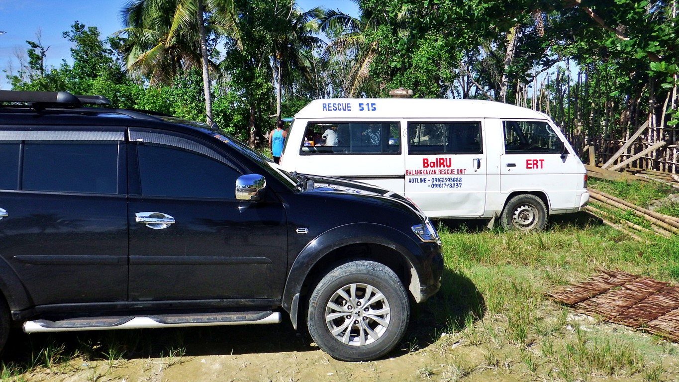 We even asked if there was an emergency. The manang said none. This is where their ERT hold office!
Then? You walk going in until you reach a bridge to the island, where you will still walk to settle down!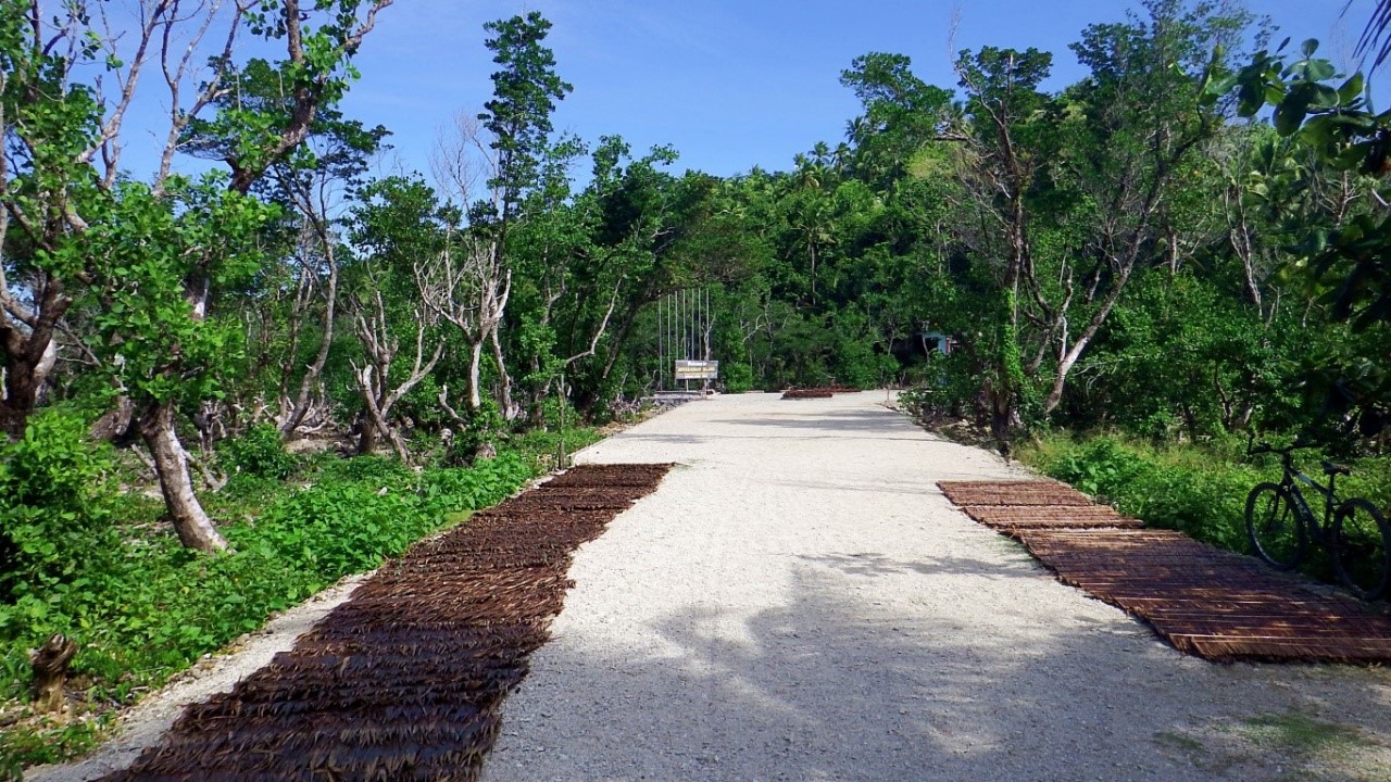 Sige walk! Until you reach the first picture above for your posterity shot. A few meters on is the bridge.
This is the bridge to Minasangay Island. As you can see, everyone must cross on foot via this bridge.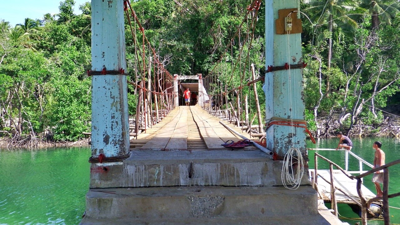 No need to mention that this place is not PWD-friendly at all. It's already very obvious. Aside from the very long walk from their parking area, look at that, you need to climb some steps to be on the bridge!
Oh, you left the entrance fee official receipt in your vehicle? You'll need to go back and get it, because: Ayan si Mana Assunta o, she needs to see the "OR" of your P20 payment! Gino-o ko! Look at that kubo photo above (where we paid entrance). It is fenced and gated. She should be there. Or that ticket kubo should be here, so we can also park here and be spared of that very long 100 meter walk. Malayo yan!
Naawa ako sa driver. He had to walk back, then return to this place just to retrieve that forty-peso-"OR" from the car. In fact I attempted to just pay another kwarenta to this manang but she said "diri puyde".
I share the drivers lamentation, that at the very least, the manang at that ticket booth, should have told us 'keep OR for inspection'. Many people, men specially, don't keep receipts in their pockets or wallets.
Anyway, while waiting for driver to walk 100m back, and another 100m to this point, I watched this: The bridge is still a long way from being finished, but can be (is) already in use. I think it is some kind of a 'miniature hanging bridge' or maybe also a 'cable-stayed' type. Okay, be creative with tiny bridges!
But I enjoyed watching those kids have fun jumping from those construction company rafts! They told me they can dive, or even do summersaults from that raft's platform, since the water is deep enough!
When driver finally arrived perspiring (but he brought our two umbrellas from the car), we were able to satisfy Manang Assunta's stringent requirements, and we were allowed to enter and cross this bridge.
And we had to start another bout of walking, this time even longer - more than a hundred meters!
Cross the bridge...
Turn right and follow the path. It goes up and down, but at least it is paved...
Continue walking. And better enjoy the cool forest-like atmosphere (dahil malayo ito)...
Keep walking. You will see the vastness of that dead mangrove forest to your right..
Go on walking. Pause to rest kung saan-saan if you need to.
Go on... walk! Did you bring water? No? Tapos ka! There are no stores on this island (yet).
You need somewhere to sit? None. As of this visit, they're still just building this whatever edifice!
Me paakyat pa, though not quite. Carry lang! And you may have to stop and stay still for a moment... A snake crossed, so we had to make way! Not big, maybe just 3 feet, about the size of an index finger.
If at this point you'd feel about to expire in exhaustion, don't yet. At least try to reach the blue tent.
Enjoy looking at many little rock islands to your right. Ponder if they're counted as part of our islands!
The blue tent, yes the blue tent! That is where their ERT (Emergency Response Team) holds office. I saw they had bottled water! I pleaded for one - kapalan na ng mukha! Kesa bumulagta ako, di ba?
And only at this point does the exciting part begins... [after about 200 meters, or more, of walking]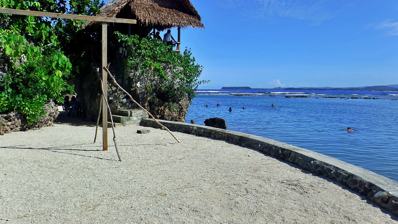 Can you see people in the water? That is just the start of a stretch of Minasangay's "natural swimming pools", harmlessly away from big Pacific waves, protected by coral rocks that you see in the distance.
Did you notice that nipa hut atop the rock? That's just one of their "day-use cottages" that you can rent for a picnic. See the paved stairs? That's your way up there. And you can jump to the water from there.
So, that's it? Well... I thought so. But NO, definitely not!
You need to look between boulders for paths within this maze! Paved pathways give it away anyway! You guessed it.., where that monobloc is, that is actually one of the 'paths' to other areas in this park.
Here's an example of the "paths between boulders" that somehow create an interesting maze! Going left has been blocked by a criss-cross of poles, right? I checked it out, they have some ongoing construction in there - just like what you see at right edge of pic. So go straight, it curves to the right...
And emerging from between those two big boulders, you stumble upon this... But if it is full like that, just follow the path (it turns left) and move to another area. There are choices!
You can sit around and watch, or join those people enjoying a time of their lives on the water...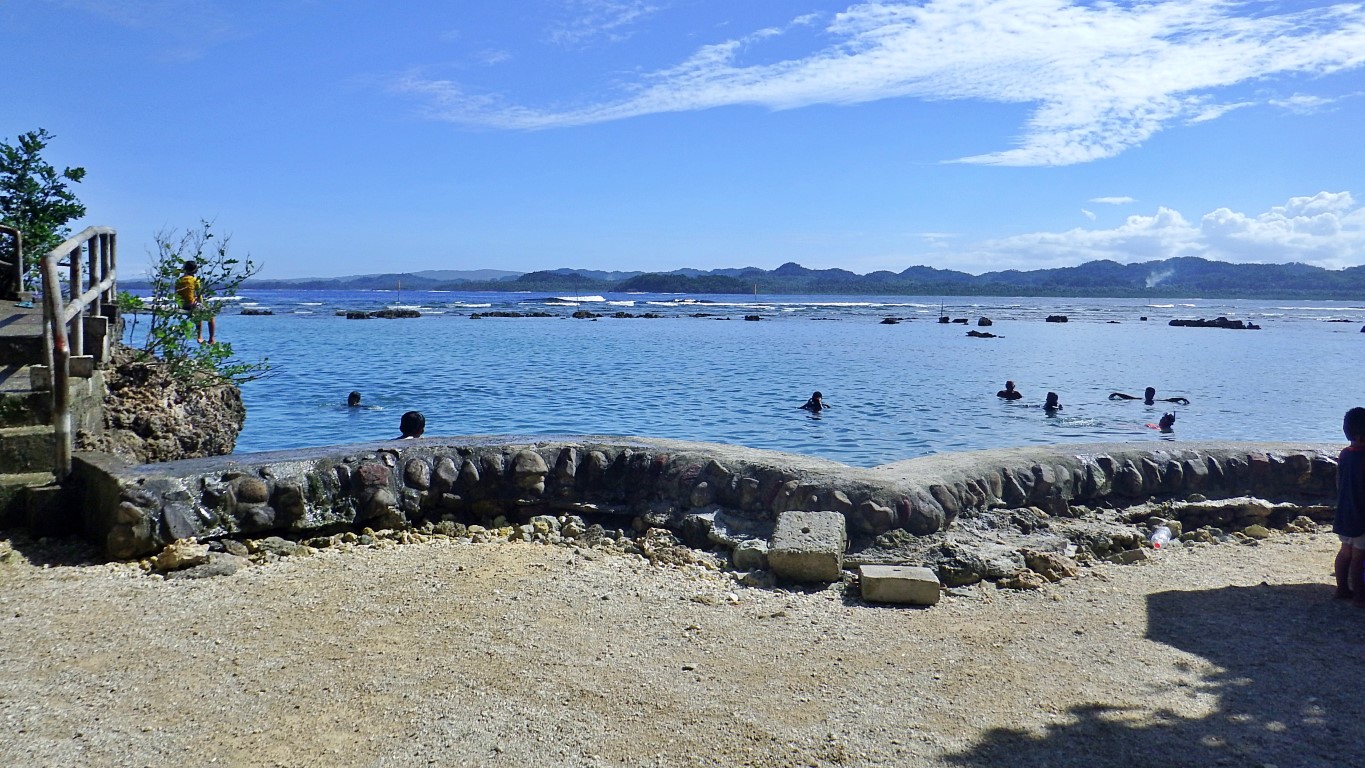 I found out, the highlight on this island is not even swimming. It's cliff-jumping (left edge of picture)!
But it's not just one 'cliff'.., there many. Look at this picture, there are three diving boards. See them?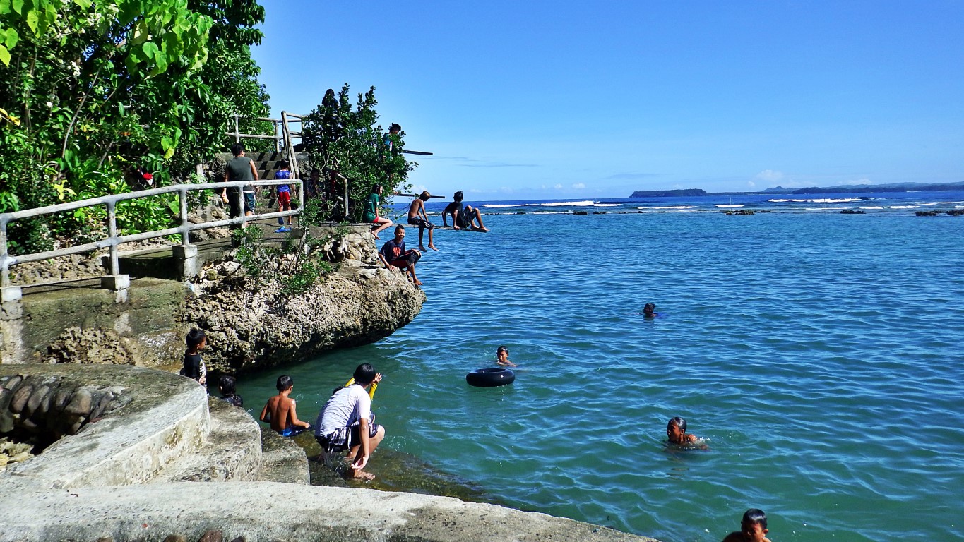
I walked up to the lowest. Here's one girl who seemed to be contemplating if she should jump or not! That is the lowest (probably 7 or 8 feet), yet it already feels too high when you stand on the platform.
But you can just walk up to the next level, if you think you can handle the height.
Look at this guy.., his stance would easily tell you, he did not feel like this was an easy jump. Duu!
But he jumped! Plus, his companion (and me too, without their knowledge) captured the moment!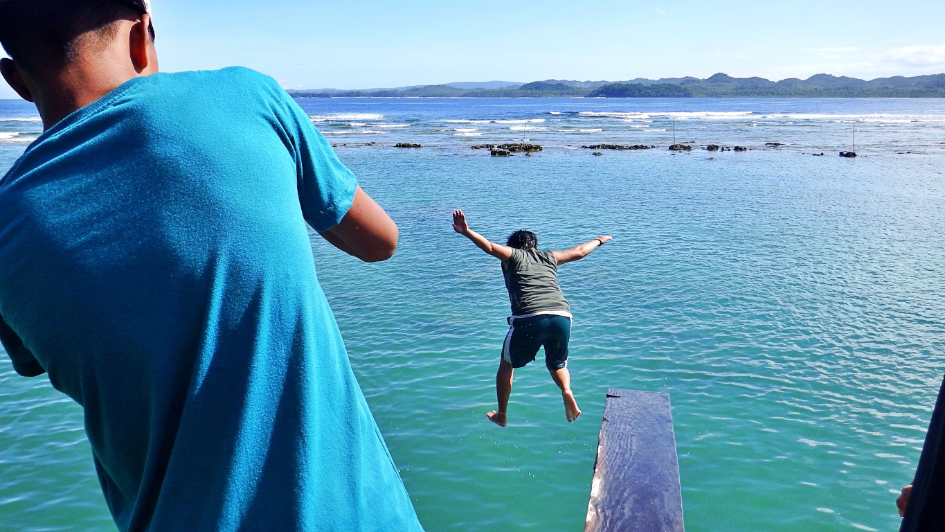
So that's it? A ridge with three jumping platforms? No!
Standing on the platform (photo above) I looked to the left (there was some shouting) and I saw this: Note that that guy seemingly floating in mid-air jumped off another board, not the one seen in this pic.
All I could say was "OMG they have so many cliffs and boards to jump from"! And at varying heights. I tried counting but easily lost track since there are rocks with just 1 plank, others with 2 or 3 and so on.
I went to that next higher jump-off board, and this was my view (of the rock where I came from)... That guy jumping is obviously an "expert"! His 'form' looks good. And that was even a "head-first dive".
While the next jumper here below.., jumped even higher first, before curling into a summersault! I assumed they are locals of Balangkayan and wondered if they ever win in the EVRAA diving events!
I (and driver) enjoyed watching them. But when I also looked left, there were yet more boards. Wow!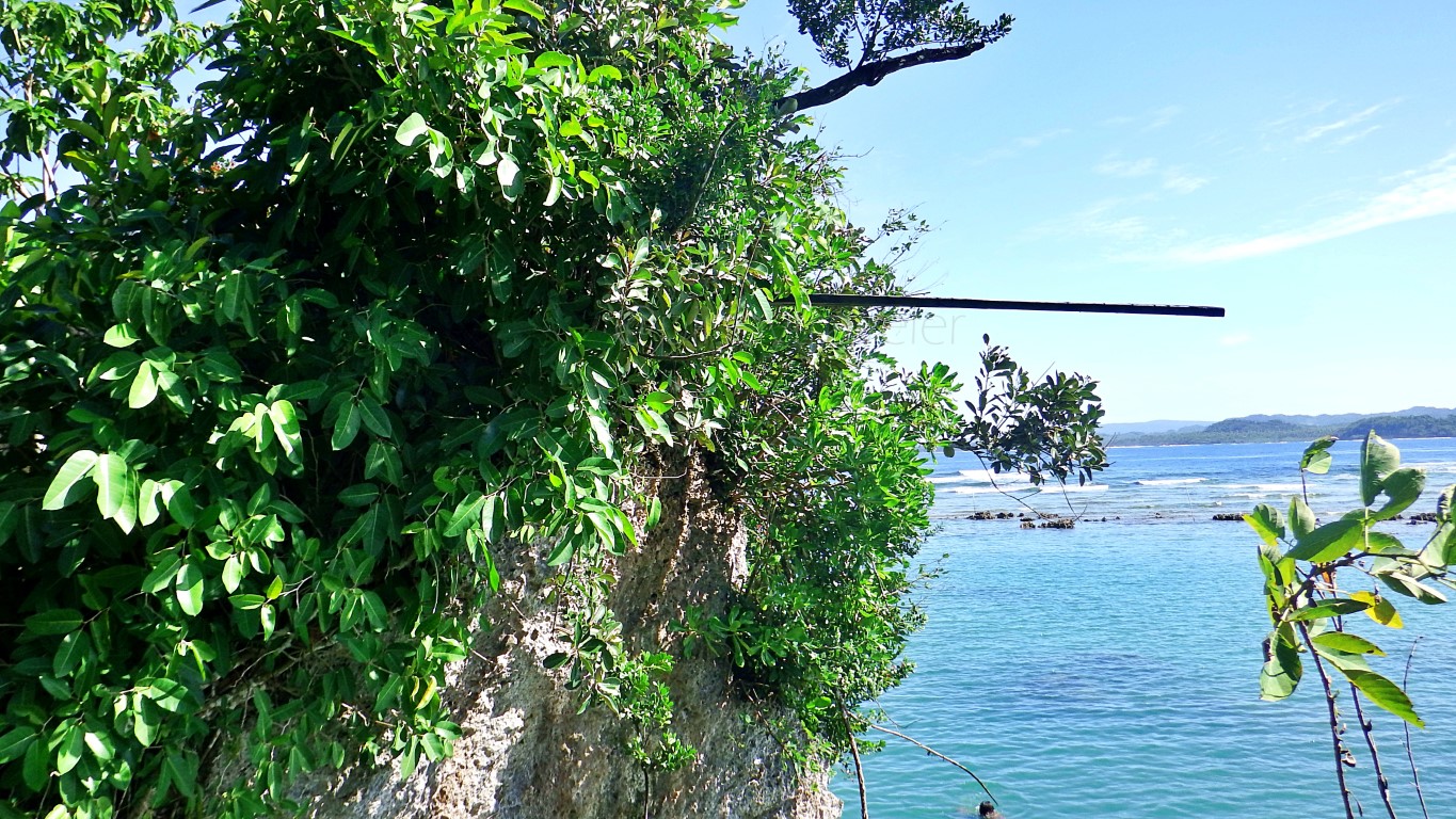 This is unlike in Boracay or elsewhere we know that only have 1 or 2 boards. Minasangay has aplenty!
 The boards jut out in various directions from the limestone rocks and are at different heights/levels. I also did not see any posted height or age requirement, so I guess it's 'jump as you wish' and wherever!
Caution though: while all the boards look sturdy as they are made of high quality Philippine hardwood, and while the ERT team is nearby, I did not see life guards or anything of that sort. So, be extra careful.

Here's a crack of a joke: while we were watching those guys (and girls and gays) jump off the boards, I asked my driver if those planks of wood would not break. He said 'that would be almost impossible' as those are of the hardest woods in the country, and they just become 'more pliant' when wet. Whoa!

Okay na sana, yet he added "kay tutal sir, kon mabari ito na tabla, mahuhulog manla it nga kabataan ha tubig, nga amo ira karuyag hingadtoan, diba"? [anyway sir, if the plank breaks, those kids will just fall to the water, which, in the first place, is where they wanted to jump-in to, right"?] May tama! Natulala ako!
Anyway, the vies from up those varying heights of cliff platforms are a thing to remember...
 I even wonder... I think those views would even be more dramatic if captured on an early morning (sun will be at left) or late afternoon (sun will be at right). Ah that would be one good reason to come back!
By the way, that land mass out in the distance (my map says) should be the town of Llorente. And that island on the left edge must be Minaanod. Hmn, I wonder what old Waray folks meant with this "mina" prefix. In Minasangay: sangay is "namesake" [Tag: tokayo], in Minaanod: anod means drift. I'm curious.
Anyway again.., we went down from that last diving platform and explored more of Minasangay...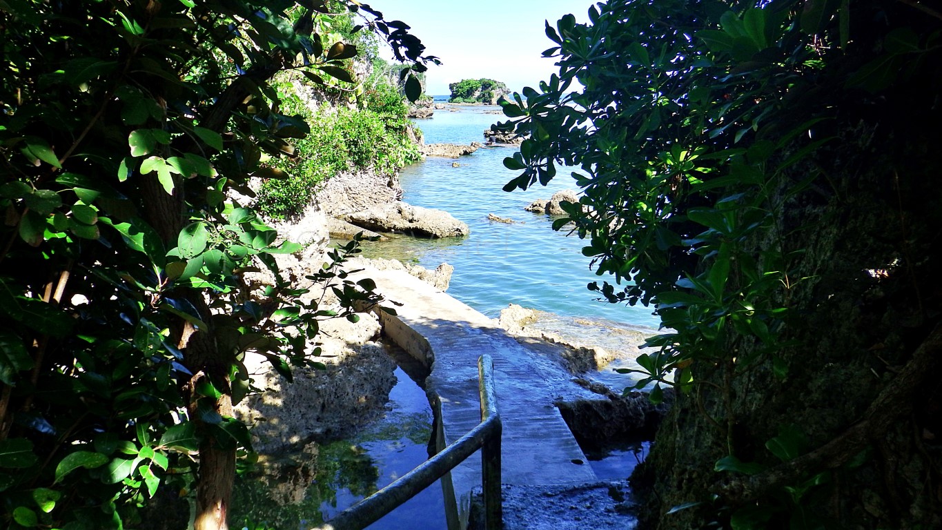
 Of course I knew, that we've been walking more than a kilometer already (not even including the going up or down those steps to the diving platforms], but the body did not mind, because the mind enjoyed!
Aside from breathtaking scenes, there were so many curious things everywhere we looked. Like this: Yes, they made concrete paths between some boulders. But those were done in some manner, where sea water (and juvenile fish, crustaceans or other fauna) are not trapped to become stagnant and die.
Magaling. In fact, all the more that those young creatures now have good hiding places to evade their predators so they can grow to become food for us! Plus, they are now easily seen or observed by kids.
Educational yes. And sometimes eerily intriguing, like this dark nook between two limestone rocks.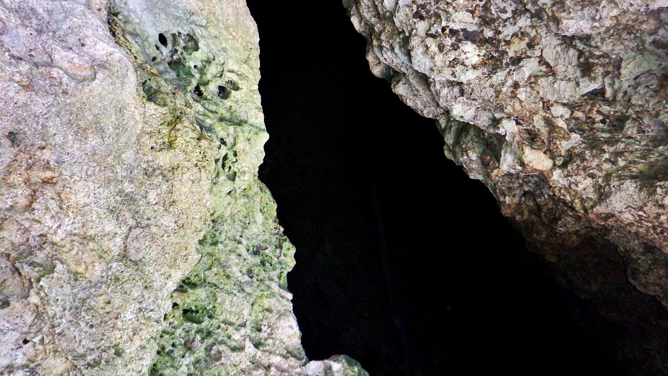 Aba, who knows what might be lurking down there, di ba? Good if it would just be something edible as in like crabs or fish. What if hiding down there.., waiting to grab your face eh... mga kampon ni Ursula?
Hahaha, I am so creative imaginative. Maybe I should try making movies hehehe! Anyway...
Towards what seemed to be the far end of the concrete paths over riprap. I saw some... fishermen? I approached and asked what they were catching. They said nothing. Oops! I learned, that yes they are fishermen, but were not here to catch fish this time. They were working under the employ of their LGU!
Their work? They were there to pile rocks and stones on the riprap, so that when it reaches the desired height according to their engineers' specifications, it'll then be cemented to continue the walking path.
Wow! But I asked how long or how far still, is that walking path supposed to go. They smiled to tell me that it's still kilometers long. Da! By my layman's brain calculations, that would take a lifetime to finish!
Also curious, my driver asked where and how do they get those big rocks and stones for that riprap. I was dumbfounded when they told us 'using that same banka, they paddle around to collect rocks and stones from this area - sometimes they even have to dive for those rocks'. OMG how utterly crude. Da!
They said 'that way' they are also able to clear rocks and stones that maybe direcly below the jumping boards and pose danger to users. Oo nga naman. Then I guess, that riprapping will really be a lifetime!
Still curious, I asked "ano ba kasi ang meron pa doon sa bandang unahan". Woa, they proudly beamed, almost in a chorus to tell us that there is a wide expanse of white-sand beach, that will very soon have day-use cottages, "resort-style" overnight accommodations, beach-volleyball, kayaks, plus many more!
I further asked "mga san-o man iton" [about when would that be]. They hesitantly looked at each other, then one enthusiastically exclaimed "next year, sir"! Driver said "okay ha, February 2017, babalik kami"!
Interesting. But then, we had to make that long arduous walk back to exit this place.
Let's be back soon and check Minasangay Island again!
It is an island yes, but very near mainland that you just cross a little bridge and walk climb jump swim your way to/at various spots of the island for a unique respite! This is in Balangkayan, Eastern Samar.

How did I know and how have I gotten to this place anyway? I kept seeing this signboard on the road!

This is to the east of the highway, and entering the service road I said "parang magandang lugar ah"!

But as we moved on.., my mind wanted to switch hehe! I wanted to say "parang hindi maganda ito ah"!

Onwards though, I had second thoughts. It looked like the dead mangroves aren't a man-made thing.

So okay, I told my big-mouthed brain "hep hep, hold your comments or criticisms, you are not yet sure of what really happened here". So, nagsitigil nga si ako! And we arrived at the entrance to Minasangay.

Parking is anywhere near that "registration hut", such as across it, where an emergency vehicle rests!

Then? You walk going in until you reach a bridge to the island, where you will still walk to settle down!

This is the bridge to Minasangay Island. As you can see, everyone must cross on foot via this bridge.

Oh, you left the entrance fee official receipt in your vehicle? You'll need to go back and get it, because:

Naawa ako sa driver. He had to walk back, then return to this place just to retrieve that forty-peso-"OR" from the car. In fact I attempted to just pay another kwarenta to this manang but she said "diri puyde".
I share the drivers lamentation, that at the very least, the manang at that ticket booth, should have told us 'keep OR for inspection'. Many people, men specially, don't keep receipts in their pockets or wallets.
Anyway, while waiting for driver to walk 100m back, and another 100m to this point, I watched this:

But I enjoyed watching those kids have fun jumping from those construction company rafts! They told me they can dive, or even do summersaults from that raft's platform, since the water is deep enough!
When driver finally arrived perspiring (but he brought our two umbrellas from the car), we were able to satisfy Manang Assunta's stringent requirements, and we were allowed to enter and cross this bridge.
And we had to start another bout of walking, this time even longer - more than a hundred meters!
Cross the bridge...

Turn right and follow the path. It goes up and down, but at least it is paved...

Continue walking. And better enjoy the cool forest-like atmosphere (dahil malayo ito)...

Keep walking. You will see the vastness of that dead mangrove forest to your right..

Go on walking. Pause to rest kung saan-saan if you need to.

Go on... walk! Did you bring water? No? Tapos ka! There are no stores on this island (yet).

You need somewhere to sit? None. As of this visit, they're still just building this whatever edifice!

Me paakyat pa, though not quite. Carry lang! And you may have to stop and stay still for a moment...

If at this point you'd feel about to expire in exhaustion, don't yet. At least try to reach the blue tent.

Enjoy looking at many little rock islands to your right. Ponder if they're counted as part of our islands!

The blue tent, yes the blue tent! That is where their ERT (Emergency Response Team) holds office.

And only at this point does the exciting part begins... [after about 200 meters, or more, of walking]

Did you notice that nipa hut atop the rock? That's just one of their "day-use cottages" that you can rent for a picnic. See the paved stairs? That's your way up there. And you can jump to the water from there.
So, that's it? Well... I thought so. But NO, definitely not!
You need to look between boulders for paths within this maze! Paved pathways give it away anyway!

Here's an example of the "paths between boulders" that somehow create an interesting maze!

And emerging from between those two big boulders, you stumble upon this...

You can sit around and watch, or join those people enjoying a time of their lives on the water...

But it's not just one 'cliff'.., there many. Look at this picture, there are three diving boards. See them?

I walked up to the lowest. Here's one girl who seemed to be contemplating if she should jump or not!

But you can just walk up to the next level, if you think you can handle the height.

Look at this guy.., his stance would easily tell you, he did not feel like this was an easy jump. Duu!

But he jumped! Plus, his companion (and me too, without their knowledge) captured the moment!

So that's it? A ridge with three jumping platforms? No!
Standing on the platform (photo above) I looked to the left (there was some shouting) and I saw this:

All I could say was "OMG they have so many cliffs and boards to jump from"! And at varying heights. I tried counting but easily lost track since there are rocks with just 1 plank, others with 2 or 3 and so on.
I went to that next higher jump-off board, and this was my view (of the rock where I came from)...

While the next jumper here below.., jumped even higher first, before curling into a summersault!

I (and driver) enjoyed watching them. But when I also looked left, there were yet more boards. Wow!


Caution though: while all the boards look sturdy as they are made of high quality Philippine hardwood, and while the ERT team is nearby, I did not see life guards or anything of that sort. So, be extra careful.

Here's a crack of a joke: while we were watching those guys (and girls and gays) jump off the boards, I asked my driver if those planks of wood would not break. He said 'that would be almost impossible' as those are of the hardest woods in the country, and they just become 'more pliant' when wet. Whoa!

Okay na sana, yet he added "kay tutal sir, kon mabari ito na tabla, mahuhulog manla it nga kabataan ha tubig, nga amo ira karuyag hingadtoan, diba"? [anyway sir, if the plank breaks, those kids will just fall to the water, which, in the first place, is where they wanted to jump-in to, right"?] May tama! Natulala ako!
Anyway, the vies from up those varying heights of cliff platforms are a thing to remember...


By the way, that land mass out in the distance (my map says) should be the town of Llorente. And that island on the left edge must be Minaanod. Hmn, I wonder what old Waray folks meant with this "mina" prefix. In Minasangay: sangay is "namesake" [Tag: tokayo], in Minaanod: anod means drift. I'm curious.
Anyway again.., we went down from that last diving platform and explored more of Minasangay...


Aside from breathtaking scenes, there were so many curious things everywhere we looked. Like this:

Magaling. In fact, all the more that those young creatures now have good hiding places to evade their predators so they can grow to become food for us! Plus, they are now easily seen or observed by kids.
Educational yes. And sometimes eerily intriguing, like this dark nook between two limestone rocks.

Hahaha, I am so creative imaginative. Maybe I should try making movies hehehe! Anyway...
Towards what seemed to be the far end of the concrete paths over riprap. I saw some... fishermen?

Their work? They were there to pile rocks and stones on the riprap, so that when it reaches the desired height according to their engineers' specifications, it'll then be cemented to continue the walking path.
Wow! But I asked how long or how far still, is that walking path supposed to go. They smiled to tell me that it's still kilometers long. Da! By my layman's brain calculations, that would take a lifetime to finish!
Also curious, my driver asked where and how do they get those big rocks and stones for that riprap. I was dumbfounded when they told us 'using that same banka, they paddle around to collect rocks and stones from this area - sometimes they even have to dive for those rocks'. OMG how utterly crude. Da!
They said 'that way' they are also able to clear rocks and stones that maybe direcly below the jumping boards and pose danger to users. Oo nga naman. Then I guess, that riprapping will really be a lifetime!
Still curious, I asked "ano ba kasi ang meron pa doon sa bandang unahan". Woa, they proudly beamed, almost in a chorus to tell us that there is a wide expanse of white-sand beach, that will very soon have day-use cottages, "resort-style" overnight accommodations, beach-volleyball, kayaks, plus many more!
I further asked "mga san-o man iton" [about when would that be]. They hesitantly looked at each other, then one enthusiastically exclaimed "next year, sir"! Driver said "okay ha, February 2017, babalik kami"!
Interesting. But then, we had to make that long arduous walk back to exit this place.
Let's be back soon and check Minasangay Island again!


Comments
Post a Comment