Sights and Scenes: Manila To Tacloban
How many times ever we travel on the same route, there will always be something new or something different and interesting worth our attention, even for just a fleeting while. It happens to me everyday.
Today was just like that. These hanging planters on the EDSA-SHAW underpass caught my attentionWouldn't our world be better and brighter if every vacant wall had that? I know some people who grow edible plants in those little hanging boxes placed around their houses. Not just beautiful, useful too!
Then again, mahal pala yan! I asked sometime ago at SM. The little boxes don't really cost that much, add in the frames that you have to hang them on. But if you sum everything, expensive pala. Because you won't need just one or two or three. You'll need many of them to create an aesthetically cool wall!
Take that underpass wall as an example.., I'll bet the reason it is not all-covered with those nice little planters is, because they (MMDA?) do not have enough of them. Sana me commercial sponsors 'no? Wouldn't it be more wonderful sponsoring the growth of plants? Than posting wide acrylic billboards?
Wouldn't that be an 'earth-friendly' endeavor. Aba, I think that would be help enough.
Anyway, let's go to my air-travel-related stories...
Take note, I left Ortigas Center at about 11AM for a 1PM departure from Terminal 3. I dared take that risk, since I knew there would be less traffic at EDSA on a noontime. I was right (this time), ayos lang!
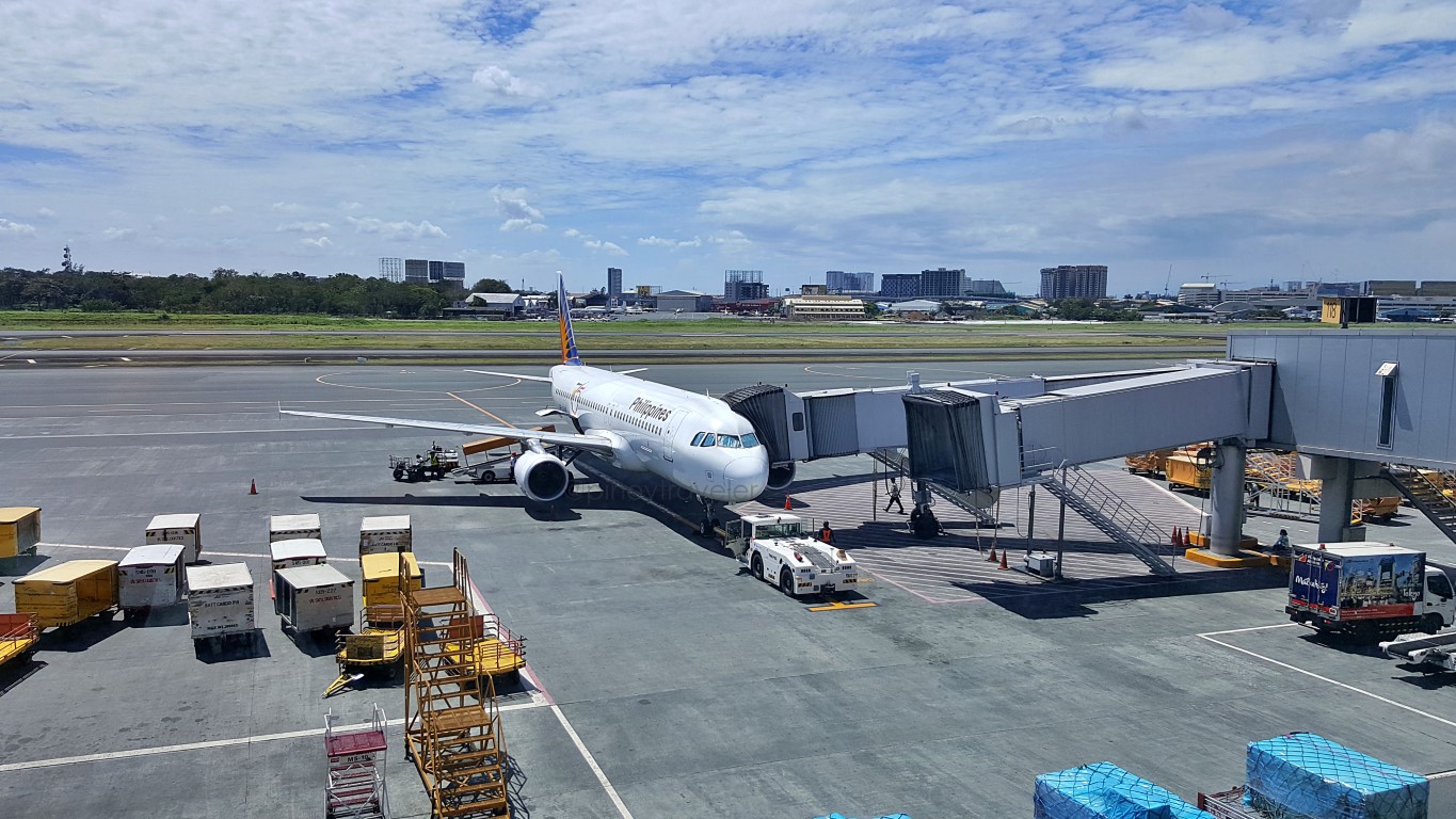
At 12:41NN, here I was about to board my PAL flight PR2985 going to Tacloban. Yes, from T3.As you probably already know, some PAL flights depart from T3 - going to TAC is one of them. But did you know, there are times these flights fly out of Terminal 2? Yes, it happened to me once. Thus, if you are flying on PAL domestic flights, it's always best to check/re-check what terminal it will depart from!
Now here is an artwork!Seriously, it's just the 'rampway', the inclining walkway from the departure gate down to the airbridge. The shadows of the aluminum frames of the terminal's glass cladding create those (almost) straight lines on the floor that look like parts of an artwork. They're not perfectly straight since the floor is not!
There are two notable things here (listen up, my "Air 101 pupils")!
One: why does the departure area have to be a floor higher than the 'general' floor level of the planes? Ah, that's what I call a design misnomer (or even a design flaw), among architects who do not think of passengers' convenience when designing airports! Let us discuss that in a separate article. Abangan!
Two: what's an airbridge? Ah, that thing na parang mahabang kahon na 'kumakabit' mismo sa plane. It has so many names, depending on the airline or airport. In the Philippines, that is called an aerobridge or airbridge. But in other places it can be called skybridge, jet bridge, jetway, jetwalk, gangway, airgate, airtube, etc! In yet other places, they even call it 'air finger' or just 'finger'! Para kasing 'daliri' ng airport!
I can't recall where.., but one article I read even calls it an ESPES (for Expedited Suspended Passenger Entry System). But its formal industry name is Passenger Boarding Bridge or PBB. Nge, bahay ni kuya!
Let me put that picture above down here, with arrows and names as to the location of the aerobridge:Look at the yellow arrows, those are the aerobridges. They are connected to a permanent non-moving structure that protrudes from the terminal building (white arrow). Yun actually ang tunay na gangway.
Here.., I grabbed this from some website sometime ago (gosh, sorry I forgot anong website yun)! Speaking of gangways, those at MNL Terminal 3 (dahil old style) have no big glass windows or walls.In my opinion, ang walls na ito dapat ang tadtad ng ads. Than leave them being "eerie white spaces"!
Anyway, we pushed back at 12:52PM for a 1PM published departure time. Oh ha? Ahead of schedule!
Plane was facing north this time, taxiing to the edge of Runway 13 for takeoff. But I took that photo to take note of everything at right. The first plane (rightmost) is at the last domestic gate of T3 and that's Gate 120. Then you may ask, how come there are more planes beyond the terminal? A good question!
Those are also aircraft parking spaces called 'parking bays'. They too have their own unique identifier names - the numbers continue to 121 'til 129 - with proper industry-required markings. However, those 'parking bays' are supposed to be only for the use of smaller 'propeller airplanes' that can't be serviced by the terminal's aerobridges, and when all gates are fully occupied to accommodate anymore planes.
But, does it happen that ALL T3 gates become fully occupied at any given time? NO, NOT YET! So, why are those yellow planes all there? What else, ano pa nga ba! Budget airline, nagtitipid.., kasi mas mura ang parking fees doon. So they park their airplanes there, they don't care if that means sacrificing your comfort and convenience, kaya sasakay ka pa sa bus (or palalakarin if Bay 121) papunta/galing doon!
Ito tsisms: me isang bubwit sa T3 ang bumulong sa atin.., na madaas daw, those parking bays (121 to 129) ang pinag-aagawan araw-araw.., not only by the different airlines using T3, but by different yellow flights mismo. Grabe, makatipid lang, di bale nang magdusa si "every Juan"! Mura nga, parusa naman!
Anyway, let's take off na! My PAL flight PR2985 took off at about 1:15PM, traffic sa taxiway.
This was my view upon takeoff.., that would be most of Taguig City down there (I was seated 1A)..,That big wide road is C6. I could see the Brgy. Hagonoy pumping station. Why am I familiar with that? Ah, across the road (to the right), that big vacant lot has a motocross track! I've been there to watch.
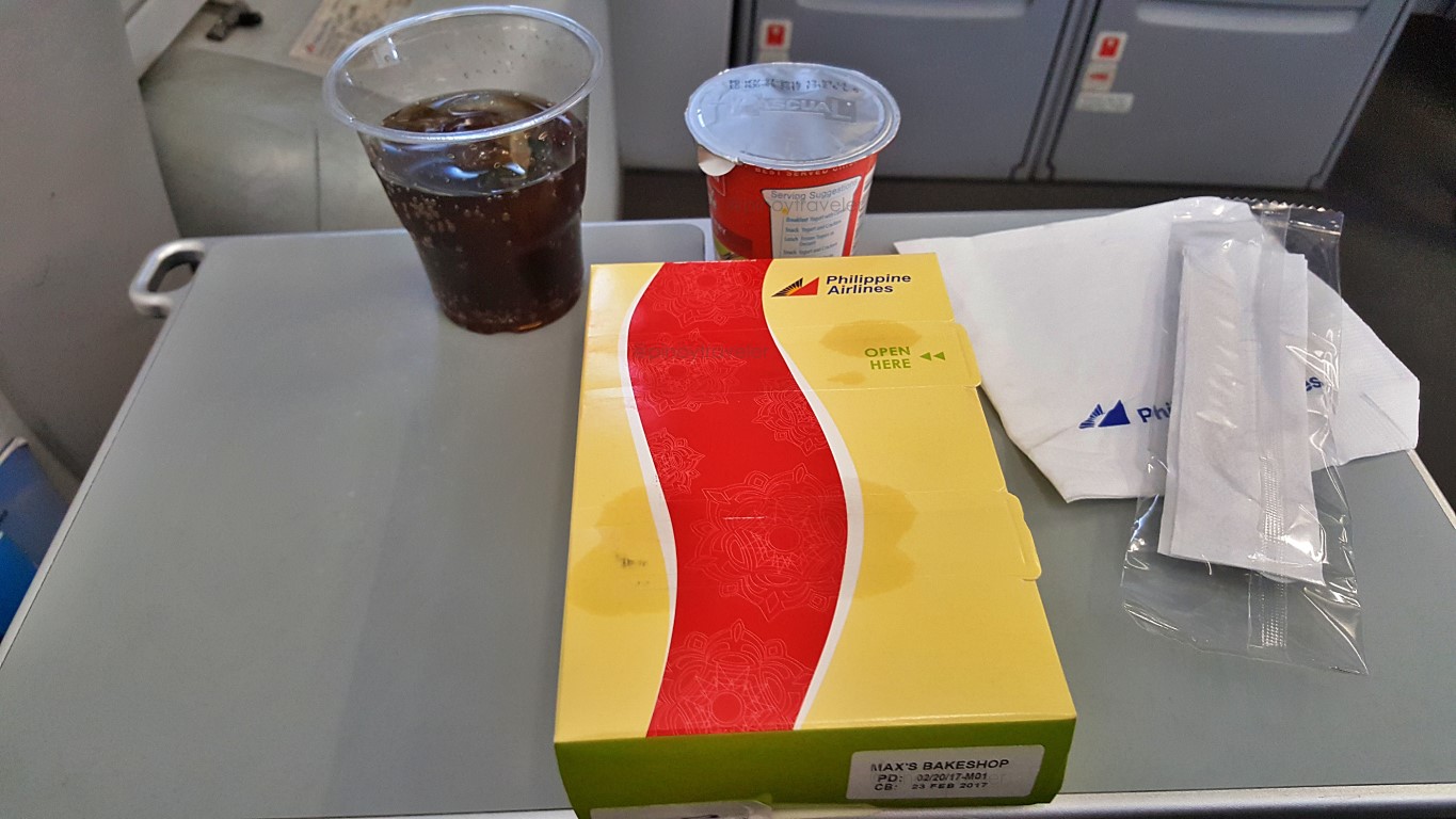
Hey there was food! I forgot there was Premium Economy on this flight and I was in it pala (Seat 1A).The first two rows of this plane (operated by PAL Express) are premium economy but the seats are no different from all others. The only difference is that there's food in this class of service. Not that I even crave for it. I needed the leg space, and those at the overwing exits were already taken when I booked.
Nice that there is Coke though! With PAL, even on domestic premium economy, you can choose what kind of 'softdrinks' you want, and the choices are Coke products, yeah! In case you're not aware, those boxed sandwiches are made by Max's for PAL. They don't anymore make them at their inflight kitchen.
That cup in the middle is a Pascual Creamy Delight pasteurized yogurt. Health food, but I'm not a fan!Sabihin mo nang 'hindi cultured', but I am not (yet) into yogurt. I know a lot of friends who love it, but I would still go for the good old "ice-cream", howsoever it is packed or served! Manul na kung manol ah!
Alam nyo ba? Hahah, I thought that yogurt product was from Pascual Laboratories (makers of Poten-Cee and ASCOF Lagundi), or di naman kaya from Pascual Liner (yung bus na sinasakyan namin from Novaliches to Baclaran nung aking kabataan)! Malay ko, baka kasi nag-diversify sila like the LT Group!
Asus! That 'Pascual' pala is a Spanish brand (Calidad Pascual), yun na nga sikat sa 'leche' (gatas yan, 'wag kang ano) and of course yogurt. Ang licensee nila in the Philippines is Asia Brewery (syempre pa, owned by LT Group). Calidad Pascual is renowned the world over. But, no matter, I still like ice-cream!
Oh okay, I saw a snippet of land over my window.., not sure if we were still over Masbate or Leyte na.But I always find it fun looking down from an airplane tryin to identify the myriad of things we fly over.
Like this one.., I was sure this was the town of Tabontabon in Leyte because I remember that church.Not that I even know the name of that church, I just remembered it becuase of its form and location in front of a park, a multipurpose building and their municipal hall. Aw.., adto man imo balay Susana uhu!
Interesting to learn too, about flight paths of commercial aircraft when about to land into a runway! On this one, just for fun, I tried analyzing our approach while the plane slowly descended. If left side view was Tabontabon (I was seated 1A) then the plane was at that time flying west to east towards Tolosa.
Why were we in the west, eh we came from Manila (north)? Because the plane circles around (spirals) to descend and approach a runway. It can't just drop directly from 35,00 feet above DZR airport, right? Hindi yan polopokter na basta nalang bubulusok from vertically above and then blag, ayun landing na!
Hahaha, who knows, maybe later technology might become so. Parang yun mga Osprey (V-22) during the Yolanda relief operations, remember? I think it is called VTOL (for Vertical Take Off and Landing).
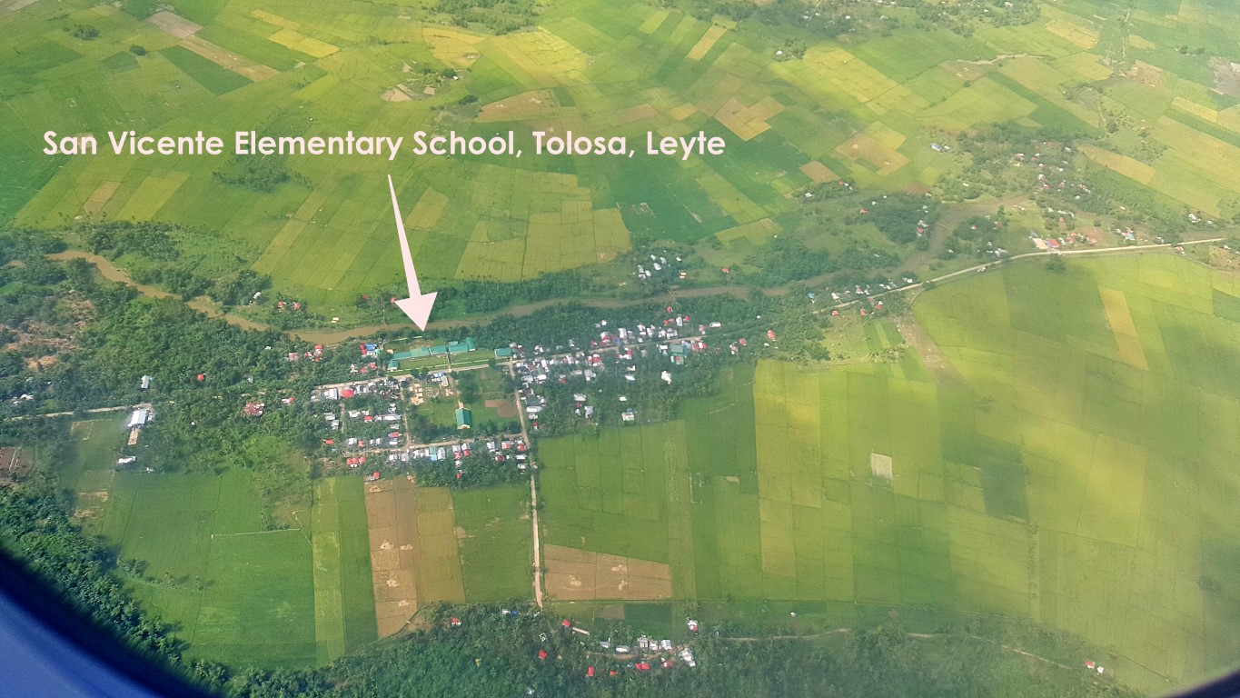
Anyway, so the plane flew over western Leyte, pababa ng pababa, probably turned left over Ormoc or Kananga, that's why we were already over Tabontabon, and turning left over Tolosa when I saw this..,How'd I know that's Brgy. San Vicente, Tolosa? I've been passing by these places since after Yolanda.
Then, this plane passed near the towns of Tolosa, Tanauan and Palo. This below is downtown Palo!The big river at left is called Binahaan River while the smaller zigzagging one at right is Bangon River!
OMG, I now know so many things hehe! That sparsely populated area at right has a lot of ongoing and up-coming developments, adding more civil and commercial institutions to their existing gov't center!
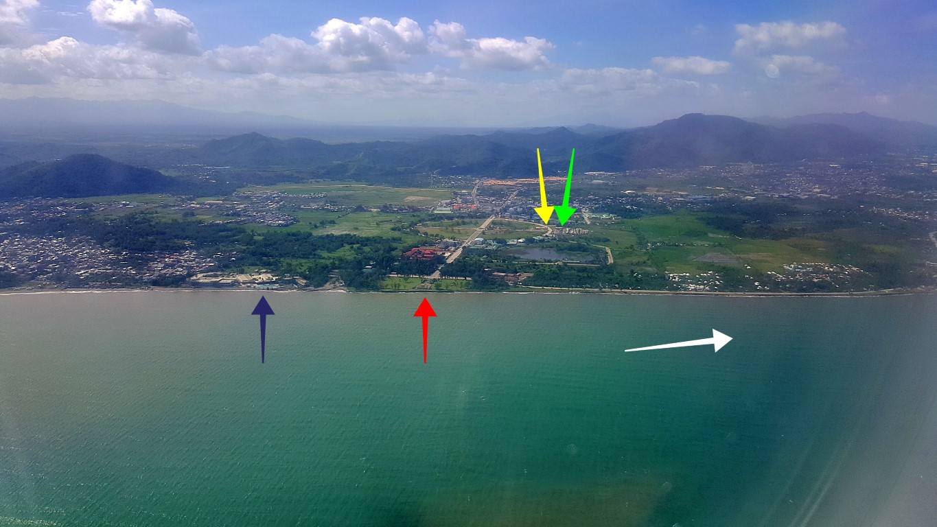
And speaking of the government center, here is a view of that expansive provincial/regional center..,The yellow arrow points to the Korean Park and green arrow to the barracks the 'K-Pop Army' built and lived at, while they helped in the Yolanda recovery of this region. They bequeathed all that to our army!
Most of the national government's regional offices are in and around that big roundabout.
Oh, that blue arrow points to the swimming pool area of The Oriental Hotel, while the red arrow points at MacArthur Landing Memorial. White arrow points to our landing direction - DZR Airport Runway 36!
It's always fun trying to spot the places you already know, as the airplane glides by!
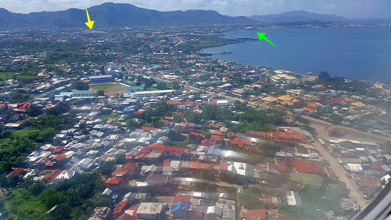
On this one, we were above the Yolanda-ravaged San Jose District of Tacloban. So many new roofs!Yellow arrow points at Robinson's Place (Marasbaras), while the green arrow points to the astrodome.
A few seconds from touchdown, I caught sight of one of the housing settlements for Yolanda victims.That's a non-government-organization-funded resettlement area by the way, since all of those that our National Housing Authority constructed (poorly) are at the northern areas of the city near Babatngon!
Oh, for those who do not know yet.., that is the Cancabato Bay.., and where is downtown? Across that body of water, behind those structures at the upper-right corner of that pic. Just 11kms for this area!
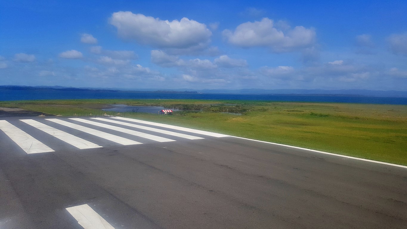
And finally I arrived! This is the edge of the runway, as the plane was making a u-turn to the terminal.That body of land out across the sea (San Juanico Strait) are the towns of Basey and Marabut, Samar.
Alright.., I was back in Tacloban again.., for the nth time hehe.., and I'm not complaining. Will not!








Comments
Post a Comment