
Let's continue my story from the previous post. While checking-in at Novotel, I got a call for a meetup in Taipei this evening. I could not say no. This was a friend I haven't seen in a long time. So I said GO!
I also needed to pass by the airport for some important arrangements, so I went there first.

It's just a glass wall (made of mirrors) but the "live" clocks, the names of cities they represent and the world map are all "in there". The entire wall is like a 3D artistic and hi-tech mural always worth a look! The names of those 120 cities in 24 time zones constantly change from English to Chinese. Interesting!
This airport is full of artistic renditions, many of which are not too obvious to the common traveler.

Various interesting things that portray the artistic prowess of the Taiwanese people. Like this one:

Anyway, after doing what I had to do at Terminal 2, I walked to Taoyuan Airport MRT Station (A13) for a less-than-an-hour ride to Taipei Main Station (A1), transfer to Red Line (R10), to reach Taipei 101 (R03).
Oh, let us clarify the names Taipei, Taoyuan and New Taipei, because I heard it confuses some people. They are three separate cities. Let's use this map we had in the previous story, to help illustrate them.

Having said that, I guess what confuses some people is the use of "Taipei" when talking about flights. Because when international operations was transferred from the old (Songshan Airport) in Taipei city, to Chiang Kai-shek International Airport in Taoyuan (1979), the name "Taipei" went with that transfer!
That proved even more confusing when in 2006 Chiang Kai-shek International Airport was renamed to Taoyuan International Airport, yet Songshan stayed operational (until now) with international flights!
So when you say I'm flying to Taipei, that is IATA Code: TPE, it lands in Taoyuan!
Magulo pa rin? Ganito... parang sa atin din yan. Ang Cagayan De Oro Airport (Lumbia), inilipat sa bayan ng Laguindingan, pero ang tawag sa kanya Cagayan De Oro Airport pa rin (IATA Code: CGY) Ganun yun!
In fact, madami nyan sa atin: ang MNL nasa (at pinag-aagawan pa nga ng) Pasay at Parañaque; ang ILO adto to sa Cabatuan kag Sta. Barbara; ang BCD ara man sa Silay; ang CEB pud kay tua ra sa Lapu-lapu!
Anyway, as the MRT entered New Taipei, I noted the sheer increase in the number of streets, highways and buildings compared to 2 decades ago. Of course there was no MRT or HSR during those times too.


This hospital must be really big if this one in the picture is just their Rehabilitation Building. Wow!

Not far from that hospital complex is this, the back of a very old temple not known to many tourists.

Look to the upper left edge of that picture above, there is a building...
They call it a museum, but it's a columbarium, the (Xinzhuang) Life Memorial Hall, and it is this:

Yes sementeryo, camposanto, himlayan whatever! During those times, manghang-mangha ako, na ang mga patay nila (urns of ashes) nasa tiny cabinets (parang library card index cabinet) sa isang building na, yun nga, ang tawag nila "museum"! I never thought that years later, magiging ganun din pala tayo!
Anyway, it's really an advantage for tourists riding elevated trains. Many things to see - tulad nyan!
Okay, still cruising along New Taipei, I saw this place with (at least) 6 volleyball plus other courts!

There really is a uniquely interesting vantage when on the elevated MRT, than riding cars or buses.

Honestly, in my mind as the train cruised along, I kept on saying "wow", because New Taipei is getting to be more like Taipei - very urban. Not that I'm so enamored with too much urbanity, but I was just a little surprised at how fast this area has developed into another jungle of highrises the past 20 years.
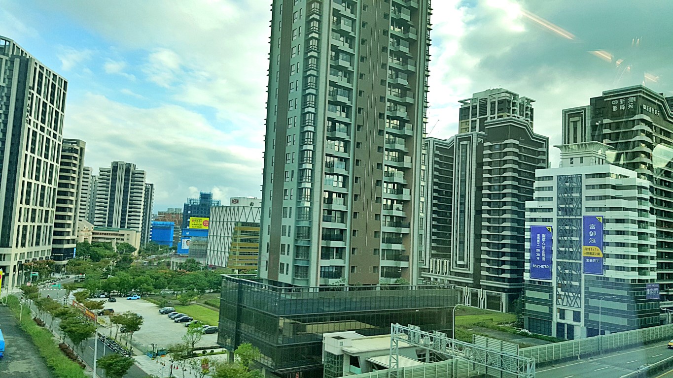
By the way, in case you are wondering about Taipei and New Taipei, they are two different cities. New Taipei is composed of the many suburbs around Taipei and Keelung. It was designated (promoted) to such a city status only in 2010. Urbanization has therefore been happening in New Taipei, long before.
Hey look, this is how they make buildings in Taiwan: hindi basta-basta ang gamit na scaffoldings!

The MRT was at this time already in the area of New Taipei City Industrial Park.


Bakit, malaki ba ang New Taipei City? Hmm, mga kasinglaki lang naman ng buong Pampanga province! Samantala ang Taipei City, I would guess, doblehin mo ang buong Quezon City. Ganun sila ka-lalapad!
Sige sige... talking about how vast this city is, next that the MRT passed-by is this Riverside Park.

This grassy field. Ilang football field yan, tatlo lang 'no? Well banda doon sa malayo is a baseball field.
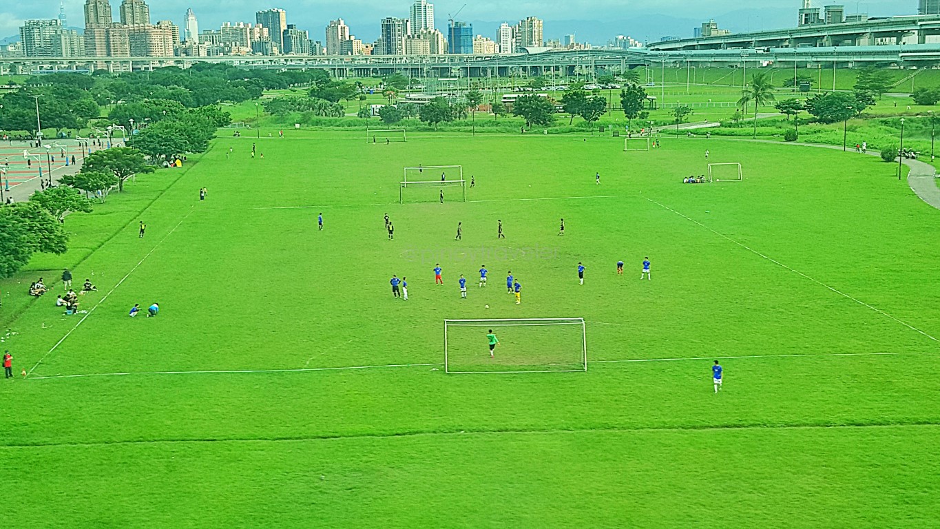
All around, especially the edges of this park are bike lanes - there are many bike rental stations. After another street (Shuhong 12th Road) is another set of 12 basketball courts and 2 baseball fields. As in!
Now, as if those were not enough, look at the upper right corner of the photo above. Ito actually yun!

The beauty of all this is that, the MRTs skirt along the sides of most of this very long public park!


So many things for adults or children alike. FYI, there is a mini zoo whatever, there are so many picnic grounds, there are flowers etc., and there are so many slides of all kinds, you can even slide your way from the MRT down to the park! Yes, many of the slides are unique, good for both adults and children!
This view is just before the MRT turned left to approach it's own crossing (tunnel) into Taipei City.

After the train's left turn, we were still in New Taipei, but that is already Taipei City across the river!

And I could already even see my final destination on this connecting ride - the Taipei 101 tower.

In no time, I reached Taipei Main Station and went to find the Red Line to connect to Taipei 101.

Well Taiwan isn't unique in having real plants and trees inside train stations. I also see some in Japan, Korea and even some Southeast Asian countries, except sa atin. Meron nga buong wall, sa Melbourne!
Pero eto na! As you would probably know, Taipei Main Station is so vast with multitudes of tracks and platforms at several floor levels, right? Parang Japan. We need to concentrate when finding our rides.
Especially at 'island platforms' - pagkababa sa escalator, kung first-timer ka, di ka sure kung sa kanan ba o kaliwa sasakay? Me ganyan tayo: Shaw Blvd Station. Pagkababa, saan ang pa-Ayala or pa-Cubao!
Clearly, you have to read the signages if you're not very well-versed with the station yet. At this time, I was not doing so. Why? Because my "ka-eyeball" called to ask where I already was, nagkukuwento na.
Honestly, I intended to ignore that call but I could not. Di ko kasi alam mag-silent mode sa fb msgr. Eh ang ingay-ingay ng talepono nakakabulahaw sa mga otaws! So I answered, while finding the Red Line.
Masaya naman, alaskahan tawanan and planning on what to do in the next few days. All that as I kept walking inside Taipei Main Station and trying to find my ride (R10), to Taipei 101 (R03) on the Red Line.
I already know the Red Line: Tamsui–Xinyi Line, and I was heading towards Xinyi, but getting off at the Taipei 101 / World Trade Center Station (R03). I easily found it (R10), there was a train, so, I hopped in.
I was still talking on the phone when I felt like it has been a bit long and I still have not arrived at the Taipei 101 Station. So I got off at the next station and found I was already at R23 - Fuxinggang Station.

Jusko! I took the wrong platform! Instead of R10 to R03, I went the other way, R23 na when I checked!

OMG but what else can I do hahaha! Nagkunwari na lang picture-picture as I waited for a ride pabalik!

The whole going and coming back took 56 minutes - halos isang oras ang ginugol ng katangahan ko!

Oh well, katulad ng nakasanayan na natin, I said "sorry natrapik sa EDSA"!


0 Comments